 English

 Home
Home Hotels
  Car Rental
 Rewards
 Travel Guide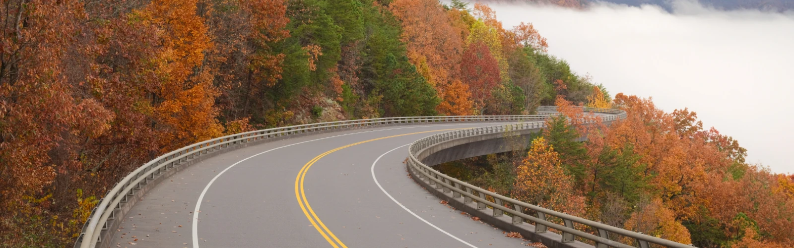
Beautiful Scenic Drives Near Gatlinburg Worth the Trip

Gatlinburg sits beside a road network that can turn an ordinary afternoon behind the wheel into one of the best parts of a Smoky Mountains visit. A driver can leave the busy Parkway and, within a relatively short distance, be following a rushing mountain stream, climbing toward a high-elevation overlook, passing historic cabins, or looking across broad ridges that seem to fade into the horizon.
That variety makes scenic drives near Gatlinburg especially useful for travelers who want to see more of the mountains without committing an entire day to hiking. Some routes work well as short outings, while others deserve several hours because stopping at overlooks, historic sites, waterfalls, and picnic areas is part of the experience. Road conditions also vary considerably. Main routes such as Newfound Gap Road and Little River Road generally remain open throughout the year when weather allows, while roads including Kuwohi Road and Roaring Fork Motor Nature Trail follow seasonal schedules.
The following drives cover everything from famous Smokies landmarks to roads where the forest itself provides most of the entertainment.
Drive Newfound Gap Road Through the Heart of the Smokies
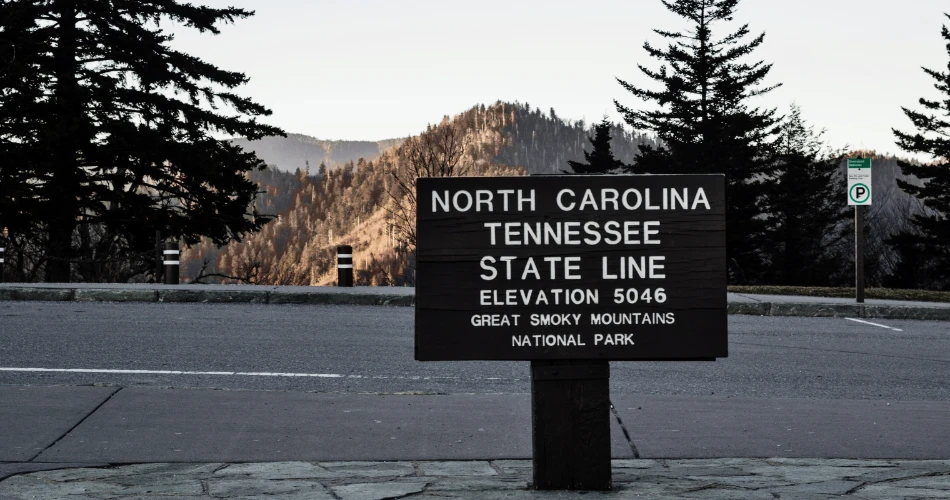
Newfound Gap Road is one of the most useful choices for a first Gatlinburg road trip because the scenery changes dramatically as the road gains elevation. Also designated U.S. 441, it crosses Great Smoky Mountains National Park between Gatlinburg and Cherokee, North Carolina, passing from lower-elevation forest into noticeably cooler mountain country.
The road eventually reaches Newfound Gap, a high mountain pass on the Tennessee–North Carolina boundary. Travelers can pull over here and look across overlapping ridges while also stepping onto a section of the Appalachian Trail. The National Park Service identifies Newfound Gap and nearby Kuwohi as part of the high-elevation crest of the Smokies, connected by Newfound Gap Road.
The pleasure of this drive comes from taking it slowly rather than treating U.S. 441 simply as a route between two towns. Mountain streams appear beside the lower sections, stone tunnels cut through ridges, and roadside overlooks become increasingly dramatic with elevation.
Drivers should remember that mountain weather can be very different from conditions in downtown Gatlinburg. Fog, snow, ice, fallen trees, and storms can temporarily affect the road even though Newfound Gap Road is considered a primary year-round route, weather permitting.
For a straightforward introduction to Great Smoky Mountains scenic drives, it is difficult to beat.
Continue From Newfound Gap to Kuwohi for High-Elevation Views
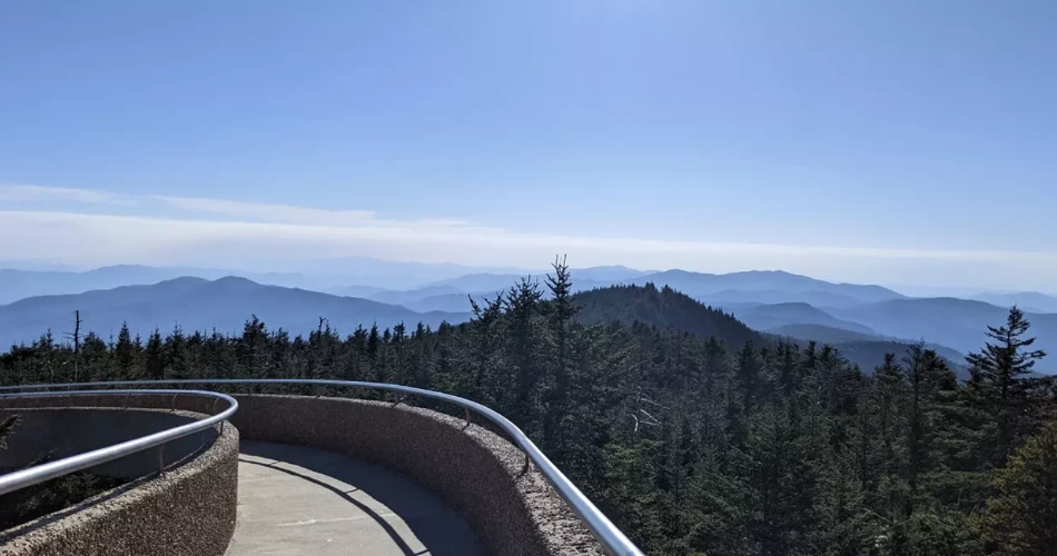
Travelers driving Newfound Gap Road during the open season can add one of the Smokies' highest-profile mountain destinations by turning onto Kuwohi Road. The destination was historically widely known as Clingmans Dome, but the mountain's official name was restored to Kuwohi in 2024. Road signs and older travel material may therefore contain both names.
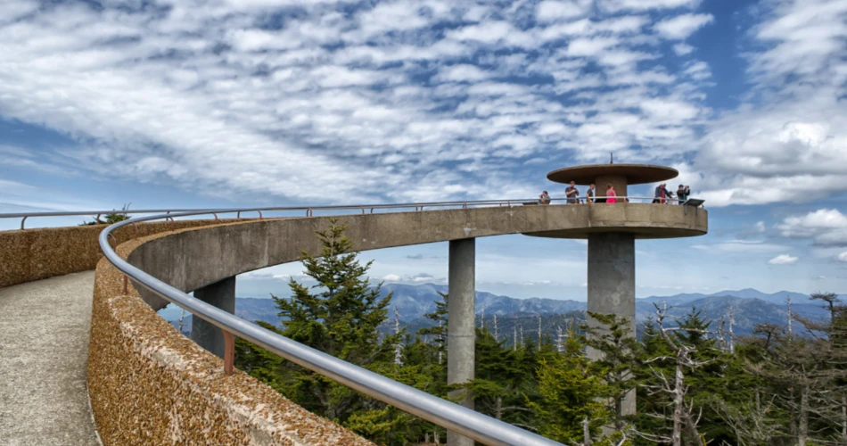
Kuwohi Road runs from Newfound Gap Road toward the visitor area below the mountain's summit. From the parking area, visitors who want the full experience can walk the steep paved path to the observation tower. The surrounding landscape is quite different from Gatlinburg's lower elevations, with high-elevation spruce-fir forest giving the area a cooler, more northern feel. The National Park Service describes the summit area as offering panoramic mountain views and access to the Appalachian Trail.
This is not a year-round extension of Newfound Gap Road. For 2026, Kuwohi Road is scheduled to operate from April 1 through November 29, subject to closures caused by snow, ice, or other hazardous conditions.
On clear days, the drive is worth doing for the changing elevation alone. On cloudy days, conditions can become atmospheric rather than panoramic, with mist moving through evergreens and across the ridgeline. Either way, travelers should bring a layer of clothing. Temperatures at the top can feel surprisingly different from those in Gatlinburg.
Take the Roaring Fork Motor Nature Trail Close to Downtown
Few scenic drives near Gatlinburg feel as close to town yet so removed from it as the Roaring Fork Motor Nature Trail. Access begins from the Gatlinburg side of the national park by following Historic Nature Trail Road toward Cherokee Orchard. Beyond the Rainbow Falls trailhead area, drivers can enter the narrow one-way motor nature trail.
The road itself is only about 5.5 miles long, but its character encourages a much slower pace. Instead of broad mountain panoramas, Roaring Fork concentrates on details: rushing water, mossy forest, old-growth trees, historic log buildings, shaded bends, and mountain slopes rising close to the pavement. The route follows the watershed associated with Roaring Fork, one of the park's larger and faster-flowing streams.
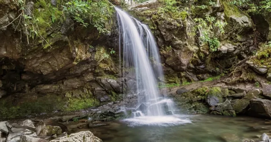
Several stops can turn the drive into a half-day outing. The Trillium Gap Trail provides access to Grotto Falls, although parking can be extremely limited. Drivers who prefer to stay close to the car can still see places such as the roadside Place of a Thousand Drips, which becomes particularly lively after rain.
The road is steep, narrow, one-way and seasonal. Buses, trailers, and motor homes are prohibited. For 2026, the scheduled season runs from April 17 through November 29.
It is a particularly good choice for travelers who enjoy forest scenery more than long-distance overlooks.
Follow Little River Road Toward Townsend
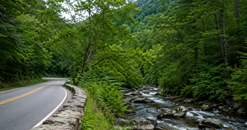
Little River Road offers a different kind of Smokies drive: less about climbing toward a summit and more about traveling beside water for mile after mile. From the Gatlinburg side of Great Smoky Mountains National Park, the road leads west toward the Townsend Wye and eventually the quieter Townsend entrance area.
The river is often visible through the trees, and numerous pull-offs provide places to stop safely rather than trying to admire the scenery while driving. Depending on the season and water level, travelers may see stretches of calm water followed by rapids rushing around large boulders. Dense forest rises above much of the route, creating a corridor that feels particularly appealing on warm summer days.
Little River Road is one of the park's primary roads and generally remains open throughout the year when weather permits. The National Park Service specifically recommends it as an alternative scenic drive when Cades Cove Loop Road is unavailable to motor vehicles.
The route also works well for travelers interested in combining several areas rather than driving out and back. Continuing toward Townsend provides access to the road leading to Cades Cove, while nearby junctions connect with other sections of the western Smokies.
For autumn visitors, patience matters. Fall foliage attracts heavy traffic, and a drive that looks short on a map can take considerably longer. Fortunately, this is one road where moving slowly hardly feels like wasted time.
Make Time for the Cades Cove Scenic Drive
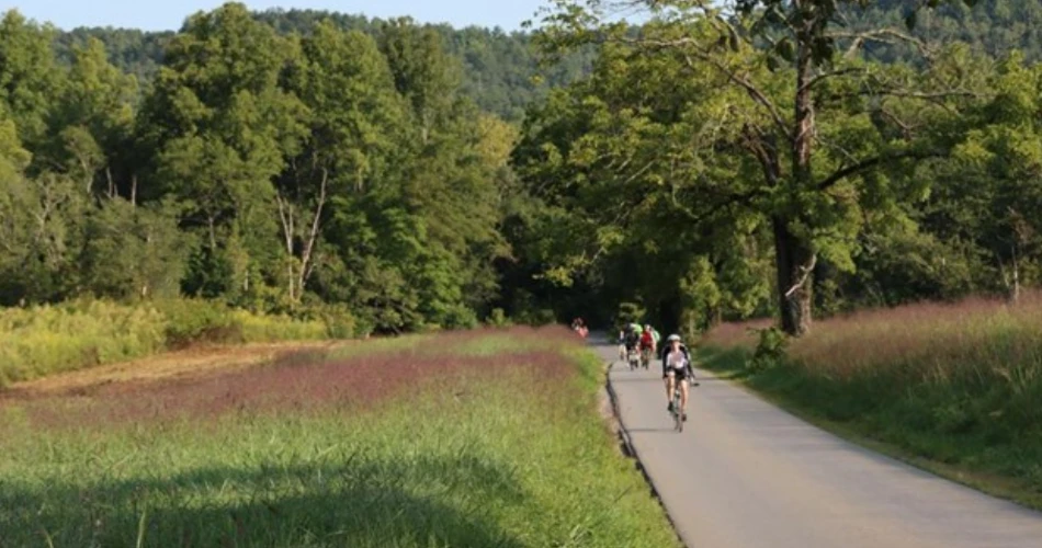
Cades Cove has earned its reputation because it combines several different reasons for visiting the Smokies in one broad mountain valley. Instead of remaining enclosed by dense forest, drivers enter open fields ringed by mountains. Historic churches, cabins, cemeteries, and homesites provide evidence of communities that lived in the cove before the establishment of the national park.
The Cades Cove scenic drive follows an 11-mile, one-way loop road. The National Park Service recommends allowing at least two to four hours, and considerably longer if travelers stop frequently or add a hike. Traffic can become heavy during summer, fall, and busy weekends.
Wildlife is another major attraction. White-tailed deer, wild turkeys and black bears may be seen in the area, but sightings should never become an excuse to block traffic or approach animals. Drivers should use designated pull-offs and maintain the required distance from wildlife.
A few practical details can prevent an unpleasant surprise:
- Cades Cove Loop Road operates from sunrise to sunset.
- From May 6 through September 30, 2026, the loop is closed to motor vehicles every Wednesday for Vehicle-Free Day.
- A parking tag is required when a vehicle is parked inside the national park for more than 15 minutes.
Anyone planning a drive should therefore avoid Wednesday during the seasonal vehicle-free period unless the goal is cycling or walking.
See Broad Mountain Ridges From Foothills Parkway
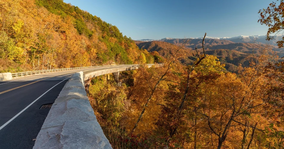
Foothills Parkway delivers the kind of scenery many travelers imagine before arriving in East Tennessee: long ridgelines, deep valleys and layers of mountains stretching toward the horizon. Unlike the forest-heavy Roaring Fork route, much of the attraction here comes from open viewpoints and the ability to see the shape of the landscape from above.
The parkway is divided into separate developed sections on the Tennessee side of Great Smoky Mountains National Park. The western section is especially convenient for travelers combining a drive with Townsend, Wears Valley or Cades Cove. National Park Service route information lists segments from Walland to Wears Valley at about 14.75 miles one way and from Chilhowee to Walland at about 16.6 miles.
Stopping at overlooks is a major part of the Foothills Parkway experience. Drivers who rush from one end to the other miss the reason the road exists. On clear mornings, distant ridges can appear sharply layered; near sunset, the mountains often become silhouettes against the western sky.
The parkway can also serve as a useful alternative when other popular areas become congested. Because weather, maintenance, rockfall, or storm damage can occasionally affect mountain roads, travelers should still check current park conditions before leaving Gatlinburg.
For people who want a relaxing drive without planning multiple hikes, Foothills Parkway deserves a high place on the list.
Head Toward Cosby for a Quieter Side of the Mountains
A scenic drive does not always need a famous overlook at the end. Driving northeast from Gatlinburg toward Cosby offers a change of pace from the busiest corridors around Sugarlands, Cades Cove and Newfound Gap.
The Cosby side of Great Smoky Mountains National Park is known more for forest, streams, trails and picnic-country atmosphere than major roadside attractions. That difference is precisely why some returning visitors enjoy it. The drive passes through a more rural landscape outside the national park, while the park entrance leads into a wooded mountain setting that feels considerably quieter than downtown Gatlinburg.
Drivers interested in extending the trip can also consider Foothills Parkway East. The National Park Service lists the eastern parkway section between Cosby and Interstate 40 at approximately 5.6 miles one way. Although short compared with Newfound Gap Road, it provides another perspective on the eastern Smokies and surrounding valleys.
Cosby makes the most sense for travelers who are not trying to collect famous landmarks one after another. A picnic, a short roadside stop, a walk near the park entrance and a leisurely drive can be enough.
It is also a useful reminder that some of the best Great Smoky Mountains scenic drives are enjoyable because the road is uncrowded and pleasant, not because every bend has a named attraction.
Choose the Right Scenic Drive for the Season
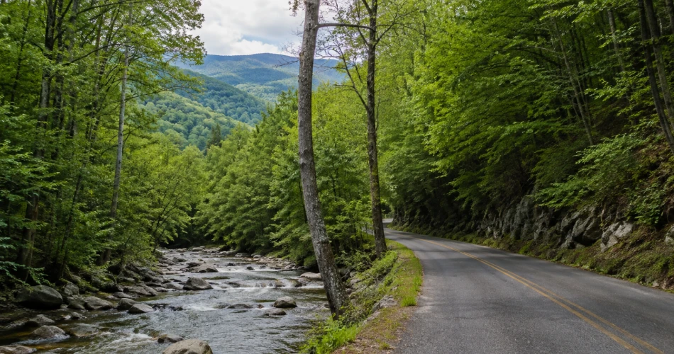
Timing can completely change a Gatlinburg road trip. Spring brings flowing streams, fresh leaves and wildflowers, while summer produces dense green forest and long daylight hours. Autumn is the busiest scenic-driving season because leaf color gradually moves from higher elevations toward the lower valleys. Winter can deliver the clearest long-range views after cold fronts, but high-elevation access becomes less predictable.
Seasonal road schedules matter just as much as scenery. In 2026, Roaring Fork Motor Nature Trail is scheduled from April 17 through November 29, while Kuwohi Road is scheduled from April 1 through November 29. Main roads including Newfound Gap Road and Little River Road generally remain open year-round, weather permitting.
Travelers should also account for parking. Popular trailheads and overlooks can fill early, and the National Park Service warns that parking demand frequently exceeds capacity in locations such as Roaring Fork and Kuwohi.
A simple plan works well:
- Leave early for Cades Cove, Kuwohi, and popular trailhead areas.
- Check road conditions on the day of the drive rather than relying on an old itinerary.
- Keep extra water and a light jacket in the car.
- Use official pull-offs instead of stopping partly in the roadway.
- Allow far more time than the mileage alone suggests.
In the Smokies, ten scenic miles can easily fill an afternoon.
Turn the Drive Into One of Gatlinburg's Best Day Trips
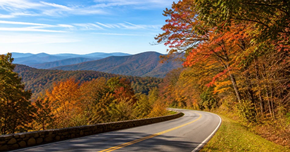
The strongest scenic drives near Gatlinburg are not simply roads used to reach another attraction. The road itself is often the attraction. Newfound Gap Road climbs from busy Gatlinburg toward the crest of the Smokies. Kuwohi adds high-elevation forest and expansive mountain views. Roaring Fork replaces distant panoramas with rushing streams and historic structures, while Little River Road follows water toward the western side of the park.
Cades Cove works best for travelers who want scenery, wildlife and history together. Foothills Parkway emphasizes wide mountain vistas, and the drive toward Cosby rewards those willing to spend part of the day away from the busiest sightseeing areas.
No single route is ideal in every season. Fog may hide an overlook while making a forest road look wonderfully moody. A summer afternoon may bring traffic to Cades Cove but leave another section of the park comparatively calm. Winter can close Kuwohi Road while leaving Little River Road perfectly usable.
That uncertainty is part of mountain travel. Instead of building the day around one non-negotiable viewpoint, visitors can keep two or three possible routes in mind and choose according to weather, road conditions and traffic.
With that flexibility, a car becomes one of the easiest ways to see how many different landscapes surround Gatlinburg—and why the drive can be every bit as memorable as the destination.
Next post Where to Go When You Want a Break From Gatlinburg
Previous Post Easy Day Trips to Take From Gatlinburg
About Author
