 English

 Home
Home Hotels
  Car Rental
 Rewards
 Travel Guide
Easy Mountain Drives to Take During a Gatlinburg Stay
Easy Mountain Drives to Take During a Gatlinburg Stay

A Gatlinburg stay does not have to revolve around long hikes or packed attraction schedules. Some of the best Smoky Mountain experiences happen from behind the wheel, with a winding road, a few well-placed overlooks, and enough time to stop whenever the scenery deserves a closer look. The area around Gatlinburg has several easy mountain drives that range from high-elevation routes to quiet forest roads and historic valleys. Newfound Gap Road provides a classic trip through the heart of Great Smoky Mountains National Park, while Roaring Fork Motor Nature Trail trades wide-open mountain views for streams, cabins, and dense forest. Cades Cove offers another kind of drive, combining scenery with historic buildings and wildlife-viewing opportunities. For travelers who want expansive views without spending an entire day on the road, sections of the Foothills Parkway can also fit neatly into a Gatlinburg itinerary. Each route has a different personality, making it easy to choose a drive based on time, weather, and the kind of scenery travelers want to see.

Newfound Gap Road for a Classic Smoky Mountain Drive
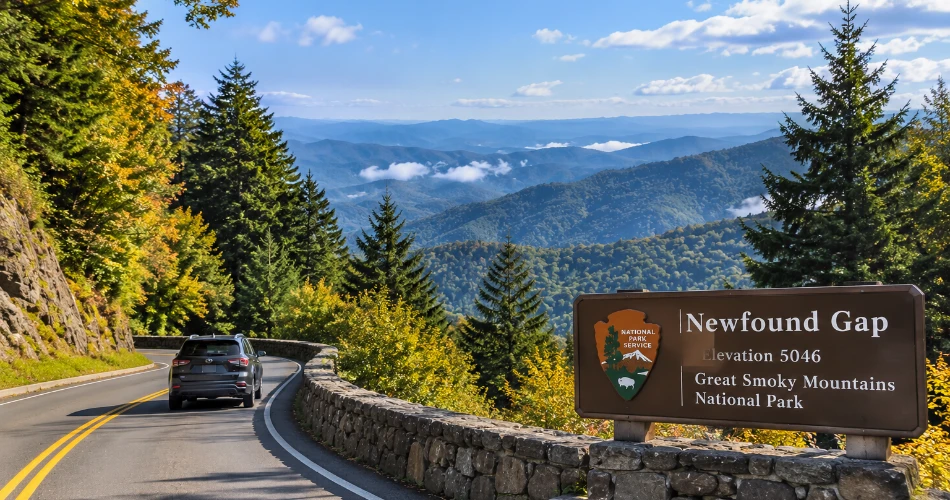
Newfound Gap Road is one of the easiest choices for travelers who want a substantial mountain drive without planning a complicated route. The road follows U.S. 441 between Gatlinburg and Cherokee, North Carolina, crossing the Great Smoky Mountains National Park and reaching Newfound Gap at 5,046 feet. That elevation makes the trip noticeably different from the lower elevations around Gatlinburg. The National Park Service notes that temperatures at Newfound Gap can be considerably cooler than in the lowlands, and weather conditions can change quickly at higher elevations.
The drive is particularly enjoyable because the landscape changes along the way. Lower sections pass through forested slopes and streams before the road climbs toward the ridge. At Newfound Gap, travelers can stop at the overlook and take in the broad mountain landscape. The Appalachian Trail also crosses the road at the gap, making the location more than just a scenic stopping point.
For a relaxed outing, travelers can drive from Gatlinburg toward Newfound Gap, stop at several designated viewpoints, spend some time at the gap, and continue toward Cherokee if road conditions permit. The route works well for first-time visitors because it combines a straightforward drive with several chances to get out of the car.
- Best for: First-time Smokies visitors and panoramic mountain scenery
- Route: U.S. 441 between Gatlinburg and Cherokee
- Standout stop: Newfound Gap at 5,046 feet
- Tip: Bring an extra layer because temperatures can be much cooler at the summit
Roaring Fork Motor Nature Trail for Forest, Streams, and History
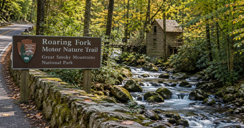
Roaring Fork Motor Nature Trail feels very different from Newfound Gap Road. Instead of concentrating on long-distance mountain views, this 5.5-mile one-way route moves through thick forest alongside the Roaring Fork stream. The road is narrow and winding, so it rewards slow driving rather than rushing from one stop to another. The National Park Service describes the route as a place where visitors can see mountain streams, mature forest, historic cabins, gristmills, and other structures associated with the area's past.
The route is especially appealing to travelers who enjoy having several small experiences during one drive. Historic structures appear along the road, while pull-offs provide opportunities to pause beside the stream or take photographs. The Place of a Thousand Drips is another memorable roadside feature, particularly after wet weather when water creates numerous small cascades down the rock face.
Roaring Fork is also convenient for a Gatlinburg itinerary because its entrance is reached from the city via Historic Nature Trail Road and the Cherokee Orchard area. It is not a route for large vehicles; buses, trailers, and motor homes are prohibited. The road also operates seasonally, so travelers should check the current road status before leaving.
For travelers with limited time, this is one of the most rewarding mountain drives in Gatlinburg because the scenery changes constantly without requiring a lengthy hike.
Cades Cove for a Slow Drive Through a Historic Valley
Cades Cove is a strong choice when the goal is not simply reaching an overlook but enjoying the drive itself. The area sits in a mountain valley surrounded by ridges, and its 11-mile one-way loop road circles the cove. The National Park Service recommends allowing at least two to four hours for the loop, with additional time needed if visitors stop for hikes or spend longer at historic sites.
The appeal of Cades Cove comes from the combination of landscape and history. The loop provides access to historic homesites, churches, cemeteries, hiking trails, and other points of interest. Wildlife viewing is also possible, although animals should always be observed from a safe distance. The valley can feel surprisingly peaceful when traffic is moving slowly and visitors take their time at the designated pullouts.
Cades Cove is not necessarily the best option for travelers looking for a quick one-hour drive. Traffic can be heavy during summer and fall and on weekends throughout the year, which can make the loop considerably slower than expected. The road is open from sunrise to sunset, weather and other conditions permitting, and it is typically closed to vehicles on Wednesdays from May through September for vehicle-free use.
A traveler planning a Cades Cove visit should treat it as a half-day outing rather than something to squeeze between several timed attractions. The slower pace is part of the experience.

Foothills Parkway for Wide Mountain Views Without a Busy Itinerary
The Foothills Parkway is one of the better choices for travelers who want broad mountain scenery and a quieter road experience. The entire planned corridor stretches 72 miles, but only three sections totaling 22.5 miles are currently completed and open to the public. The National Park Service identifies the open segments as Cosby to I-40, Walland to Wears Valley, and Chilhowee to Walland.
For a Gatlinburg stay, the western sections can be especially useful when travelers want to turn a drive into a scenic outing. The Walland-to-Wears Valley section provides elevated views across the foothills, while the longer Chilhowee-to-Walland section has numerous parking areas, including multiple scenic overlooks. The latter route is 16.6 miles one way and climbs along the foothills with views toward Great Smoky Mountains National Park and the Maryville and Alcoa areas.
The eastern Cosby-to-I-40 section is much shorter at 5.6 miles one way but still provides expansive views. It climbs about 1,000 feet along Green Mountain and has four scenic overlooks, including Green Mountain Overlook, which faces southeast and can work well for sunrise viewing.
The Foothills Parkway is best approached as a scenic road rather than a destination with one major attraction. Travelers can stop at overlooks, take photographs, enjoy a picnic where facilities are available, and continue at their own pace.

Little River Road for a Relaxed Drive Beside the Water
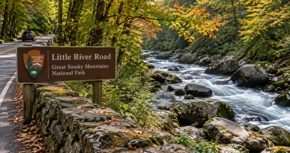
Little River Road offers a different kind of Smoky Mountains scenic drive. Rather than focusing primarily on high ridgelines, the route follows the Little River through a forested landscape and connects the Gatlinburg side of the park with the Townsend area. It is a useful option when travelers want to spend time outdoors without committing to a strenuous trail or a long list of stops.
The road works particularly well for travelers who enjoy water views. The river appears alongside the road at various points, and designated pull-offs provide opportunities to stop without turning the drive into a formal hiking excursion. The changing forest scenery also makes the route worthwhile in different seasons. Spring brings fresh greenery and flowering plants, summer creates dense forest cover, and autumn changes the roadside landscape as leaves turn.
One useful advantage is flexibility. Travelers can drive part of the road and turn around rather than completing a longer route. That makes it easy to combine with other areas of the park during the same day. Meigs Falls is one of the recognizable roadside attractions along Little River Road, located between mile markers 7 and 8.
For visitors who have already taken Newfound Gap Road and want something less focused on elevation, Little River Road makes a sensible second choice. It provides a quieter rhythm, especially when the goal is simply to drive, stop occasionally, and enjoy the scenery rather than chase a particular viewpoint.
Greenbrier for a Quieter Side of the Smokies
Greenbrier is a good option for travelers who want to step away from some of the heavier traffic associated with the park's best-known routes. Located approximately 20 minutes east of Gatlinburg, the Greenbrier area is known for its heavily forested setting and access to streams, picnic areas, and trails. The National Park Service identifies Greenbrier as one of the park's areas on the Tennessee side, east of Gatlinburg.
The drive toward Greenbrier is enjoyable because the surroundings quickly become more natural as the developed parts of Gatlinburg fall behind. Instead of looking for a single dramatic overlook, travelers can enjoy the changing forest, mountain slopes, and water along the route. This makes Greenbrier especially suitable for a slower morning or afternoon when visitors want scenery without building an entire day around major attractions.
It is also a practical choice for travelers who prefer combining driving with a short outdoor stop. Greenbrier provides access to trails and picnic opportunities, so a traveler can bring lunch, walk for a while, and then continue the drive. The area is not as heavily structured around a single loop road as Cades Cove, which allows visitors to create a more flexible itinerary.
For returning Smoky Mountains visitors, Greenbrier can provide a welcome change from the most familiar routes. For first-time visitors, it offers another perspective on how quickly the landscape changes outside Gatlinburg.

Cosby and the Eastern Foothills for a Short Scenic Detour
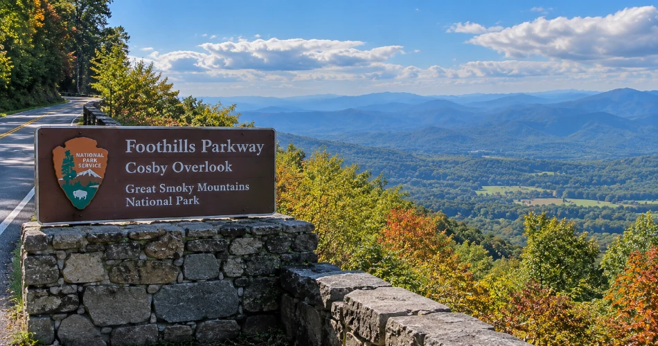
Travelers who have a little extra time and want to see a less crowded side of the Smokies can head toward Cosby and the eastern section of the Foothills Parkway. The Cosby-to-I-40 section is only 5.6 miles one way, making it one of the more manageable scenic routes near Gatlinburg. Despite its short length, the road climbs along Green Mountain and provides several overlooks with views across the eastern Appalachian landscape.
The four overlooks create natural stopping points without requiring a complicated itinerary. Cosby Overlook faces southwest, Green Mountain Overlook faces southeast, Allen Grove Overlook faces northwest, and Greasy Cove Overlook also provides views toward the surrounding landscape.
This drive can work particularly well as part of a broader eastern Smokies outing. Travelers can take their time at the overlooks and then continue toward Interstate 40, or reverse the route depending on their plans. Cosby also has a picnic area, giving visitors another opportunity to pause outdoors.
The eastern side of the park often appeals to travelers who have already spent time around Gatlinburg's busiest areas. It does not offer the same concentration of attractions, but that is precisely the point. The drive is about mountain scenery, open viewpoints, and a road that encourages travelers to slow down. Anyone planning to visit should still check current road conditions and closures before setting out, particularly when weather changes.
How to Make the Most of Gatlinburg Scenic Drives
The best Gatlinburg scenic drives are rarely improved by rushing. Mountain roads have curves, changing elevations, narrow sections, wildlife, cyclists, and other visitors who may stop unexpectedly for photographs. A relaxed schedule gives travelers more freedom to pull into designated areas, wait for a clear view, and enjoy the surroundings without watching the clock.
A few practical details can make the experience considerably easier:
- Check road status before leaving, especially for secondary roads that close seasonally or during hazardous weather. Primary roads such as Newfound Gap Road and Little River Road generally remain open year-round when weather permits, while secondary roads can have seasonal closures.
- Carry layers because temperatures at higher elevations can be substantially different from those in Gatlinburg.
- Use designated pull-offs instead of stopping in travel lanes or on road shoulders.
- Allow more time than the mileage suggests, particularly for Cades Cove and Roaring Fork.
- A parking tag is required when parking in Great Smoky Mountains National Park for more than 15 minutes.
- Keep food and belongings secure and observe wildlife from a safe distance.
Travelers should also avoid planning every minute of a scenic drive. A mountain road is at its best when there is enough flexibility to stop for an unexpected view, spend longer at an overlook, or simply continue slowly through the forest. For a first visit, Newfound Gap Road is an excellent starting point. Roaring Fork suits travelers interested in forests and history, Cades Cove works for a longer sightseeing outing, and the Foothills Parkway is ideal when sweeping views are the priority. With several distinct options within reach, a Gatlinburg stay can easily include more than one road trip without making the itinerary feel repetitive.
Next post Where Can You Go From Gatlinburg in One Day?
Previous Post Places to Visit Near Gatlinburg When You Have a Car
About Author
