 English

 Home
Home Hotels
  Car Rental
 Rewards
 Travel Guide
Scenic Hiking Trails to Explore Near Gatlinburg

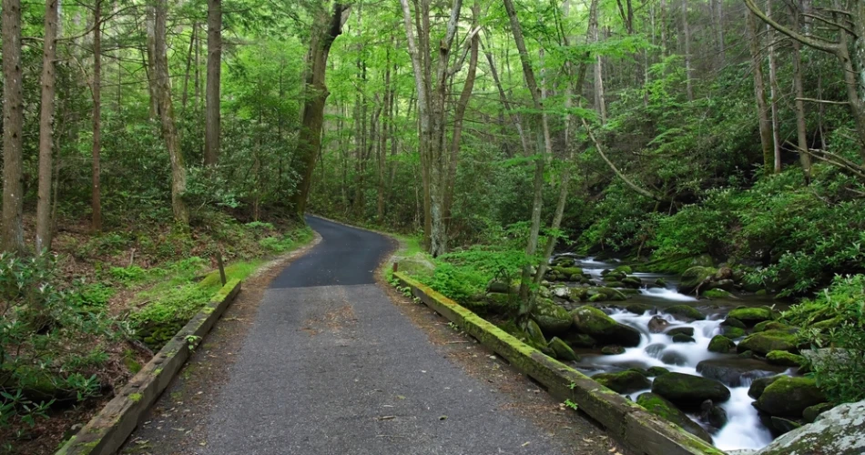
Gatlinburg is one of those places where a short drive can change the entire feel of a day. One moment there are restaurants, shops, and busy streets, and shortly afterward the road is climbing through the forests of Great Smoky Mountains National Park. For travelers who would rather spend their time outdoors, the area has an impressive range of trails, from easy riverside walks to demanding mountain climbs. The scenery changes with elevation, weather, and season, so returning visitors can have a very different experience on the same trail.
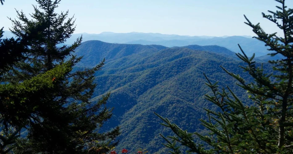
The best hiking trails near Gatlinburg are not limited to one type of landscape. Some follow rushing streams, others lead to waterfalls or rocky overlooks, while high-elevation routes provide wide mountain views. Several popular trails are also busy, particularly during peak travel periods, making an early start and some flexibility useful. The following trails offer a practical look at what hikers can expect, including distance, scenery, difficulty, parking considerations, and the kind of experience each route provides.
Choosing the Right Hiking Trails Near Gatlinburg
Choosing a trail around Gatlinburg is less about finding the longest or most famous route and more about matching the hike to the group. Great Smoky Mountains National Park contains more than 800 miles of trails, and conditions can change because of rain, fallen trees, erosion, stream crossings, and other mountain hazards. The National Park Service recommends checking an official trail map before setting out rather than assuming that a short distance automatically means an easy hike.
For a relaxed outing, a riverside trail such as the Gatlinburg Trail is considerably different from a steep route toward Mount Le Conte. Families and casual walkers may prefer shorter routes with manageable elevation gain, while experienced hikers can choose longer climbs such as Rainbow Falls toward Mount Le Conte. Weather should also influence the decision. A trail that feels comfortable on a cool autumn morning may be much more demanding during a hot summer afternoon.
Parking is another practical consideration. Popular trailheads can fill quickly, and a parking tag does not guarantee a parking space. The park lists limited parking at destinations including Alum Cave, Chimney Tops, Rainbow Falls, Grotto Falls, and Laurel Falls. Shuttle services can be particularly useful during busy periods.
Best Scenic Trails Gatlinburg Has Close to Town
The advantage of scenic trails Gatlinburg visitors can reach without committing to an entire day is that a hike can easily be fitted around other plans. Some routes begin close enough to town to make a morning hike practical, while others require a drive into the national park but reward the effort with a more secluded mountain setting. The scenery also varies dramatically, which means travelers do not have to repeat the same type of hike throughout their stay.
Gatlinburg Trail
The Gatlinburg Trail is one of the easiest choices for visitors wanting a straightforward introduction to Gatlinburg hiking trails. The route runs approximately four miles roundtrip between Sugarlands Visitor Center and River Road in Gatlinburg. It follows the West Prong of the Little Pigeon River through a cove hardwood forest, giving hikers a pleasant combination of water, trees, bridges, and historic remnants. The National Park Service also identifies it as one of only two park trails where dogs and bicycles are permitted.
The trail is useful for travelers who want scenery without taking on a major mountain climb. It has some steeper portions, but much of the route is wide and well graded. Near the trailhead, visitors can also see historic stone chimneys, reminders that the landscape was home to communities before the park was established.
Alum Cave Bluffs
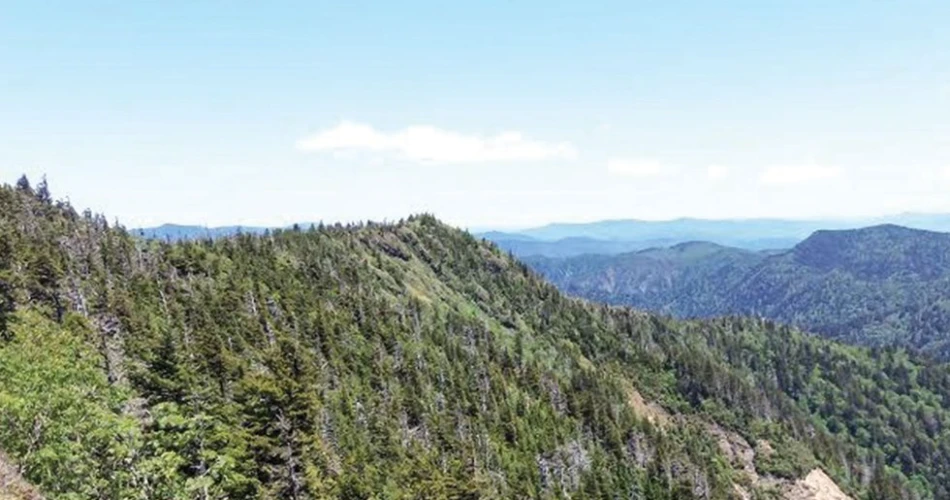
Alum Cave Bluffs provides a more dramatic experience. The hike to the bluffs is 4.6 miles roundtrip and passes through old-growth forest, mountain streams, and Arch Rock before reaching the large rock overhang known as Alum Cave Bluffs. The trail becomes noticeably steeper after Arch Rock, so hikers looking for a shorter outing can turn around there after approximately 2.8 miles roundtrip.
The route is particularly appealing because the scenery keeps changing. Instead of walking through one continuous forest landscape, hikers encounter streams, rock formations, stairs, and increasingly elevated views. Stronger hikers can continue beyond the bluffs toward Mount Le Conte, but that turns the outing into a substantially longer and more strenuous day.
Andrews Bald
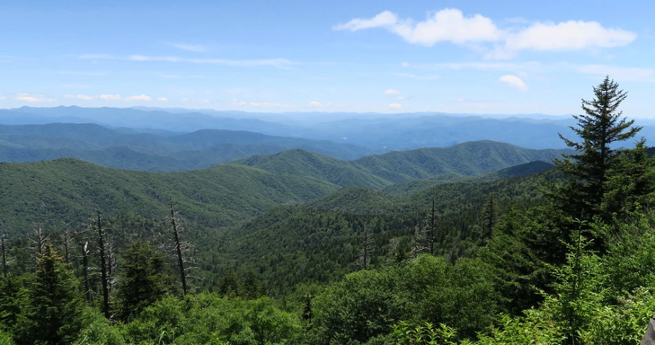
Andrews Bald is a strong choice for travelers who want high-elevation scenery without taking on one of the area's longest hikes. The roundtrip distance is 3.6 miles from the Forney Ridge Trailhead near Kuwohi, formerly known as Clingmans Dome. The route passes through spruce-fir forest before reaching a grassy bald with views across the surrounding mountains. In summer, flowering azaleas can add seasonal color to the landscape.
The return journey is more demanding than some visitors expect because the trail descends first and requires a climb back to the trailhead. High elevation also means conditions can differ considerably from Gatlinburg. Travelers should check weather conditions before heading up and plan for colder or changing conditions.
Waterfall Hikes Worth the Drive From Gatlinburg
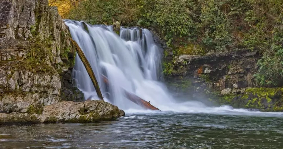
Waterfalls are among the most popular reasons people choose Smoky Mountains hiking, and the Gatlinburg area provides several routes where flowing water is part of the experience. Some waterfalls require a serious commitment, while others can be reached on a manageable day hike. The sound of water also makes these trails particularly enjoyable after periods of rain, although wet weather can make rocks, roots, and stream crossings slippery.
Rainbow Falls
Rainbow Falls is one of the better-known waterfall hikes near Gatlinburg. The trail follows a creek through the forest and reaches the waterfall approximately 2.2 miles from the trailhead. Hikers continuing all the way to Mount Le Conte face a 13-mile roundtrip journey with steep and rocky sections, so reaching Rainbow Falls can be treated as its own destination rather than simply the beginning of a much longer climb.
The waterfall itself drops over a rocky ledge, and mist can create the effect that gives Rainbow Falls its name when sunlight hits the water. The trail is not a casual stroll, however. Anyone planning to continue beyond the falls should allow plenty of time, carry sufficient water, and understand that the route becomes increasingly demanding.
Porters Creek Trail
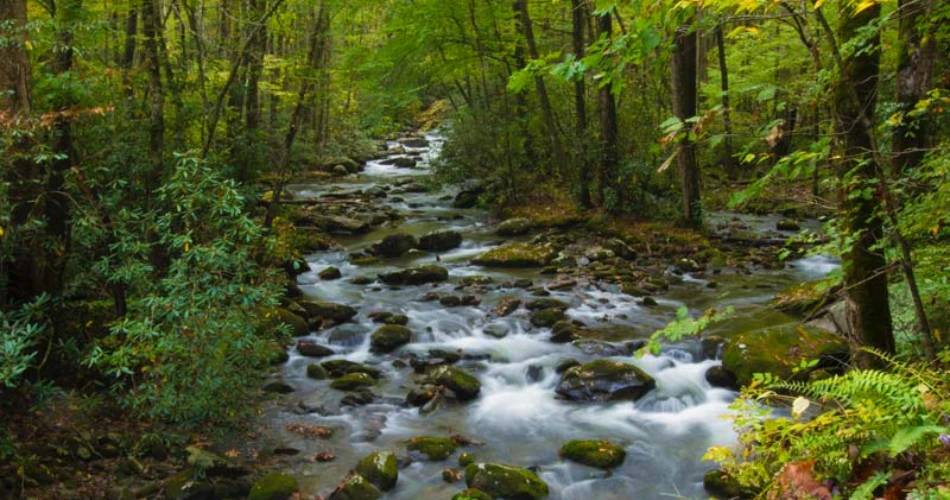
Porters Creek Trail offers a quieter alternative for travelers who prefer a mixture of nature and history. Located in the Greenbrier area, the trail passes historic features before reaching Fern Branch Falls, a 40-foot waterfall. Many hikers turn around after reaching the falls at roughly two miles, creating a manageable waterfall outing.
The route also passes the Great Smoky Mountains Hiking Club Cabin and the Messer Barn area, adding cultural interest to the forest scenery. Roots, rocks, stream crossings, and elevation changes mean that the trail still requires appropriate footwear. Compared with some of the park's most famous waterfall hikes, Porters Creek can feel more relaxed, particularly for visitors willing to hike early and avoid the busiest periods.
Mountain Views and High-Elevation Hiking
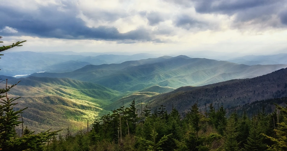
Some of the most memorable Great Smoky Mountains trails are those where the trees eventually open enough to reveal the ridges and valleys beyond. These hikes often require more effort than riverside walks because gaining elevation is unavoidable. The reward is a different perspective of the Smokies, where layers of mountains stretch into the distance rather than being viewed only from inside the forest.
High-elevation hikes also require more preparation. Temperatures can be cooler than in Gatlinburg, and clouds or fog can arrive quickly. During colder months, ice can become a serious concern on steep sections. The National Park Service specifically warns hikers about winter ice and falling icicles on routes such as Alum Cave and Rainbow Falls toward Mount Le Conte.
Andrews Bald is one of the more approachable choices for mountain scenery, while Alum Cave offers a combination of geological features and elevated views. For experienced hikers with a full day available, continuing from Rainbow Falls to Mount Le Conte creates a substantially more demanding adventure. Mount Le Conte rises to 6,593 feet, with viewpoints including Cliff Top and Myrtle Point near the summit.
For travelers primarily interested in photographs and scenery, the best approach is not necessarily to chase the highest summit. A moderate hike that leaves enough energy to enjoy the landscape can often provide a more rewarding day than an exhausting climb undertaken simply for distance.
Easy and Relaxing Hiking in Gatlinburg

Not every day in the Smokies needs to involve a difficult climb. Hiking in Gatlinburg can also mean taking a slow walk beside a river, stopping frequently for photographs, watching birds, or simply enjoying the forest. Easy routes are especially useful for visitors traveling with children, older family members, or anyone who wants outdoor time without turning the hike into a major physical challenge.
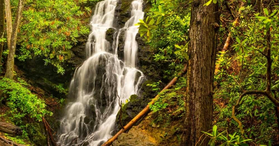
The Gatlinburg Trail is particularly practical because of its relatively gentle layout and access from Sugarlands Visitor Center. The route combines forest scenery with the sound of the river and does not require hikers to reach a summit to feel that they have experienced the Smokies. Another option around Sugarlands is the short walk toward Cataract Falls. The National Park Service describes the Cataract Falls route as a side route of about half a mile one way, making it useful for visitors looking for a shorter outing.
Easy trails should still be treated as genuine mountain environments. Visitors need water, appropriate shoes, weather awareness, and enough daylight to complete the route comfortably. A slower pace can actually make these trails more enjoyable because hikers have more time to notice wildflowers, birds, tree species, creek crossings, and historic structures that are easy to miss when rushing.
What to Know Before Hiking Near Gatlinburg
A successful hiking day in the Smokies begins before reaching the trailhead. Parking is one of the biggest practical issues on popular routes. The National Park Service states that parking is first come, first served and that a valid parking tag does not reserve a space. Popular trailheads can reach capacity, especially during peak travel periods.
Visitors should also remember that a parking tag is required when parking in the park for more than 15 minutes. Checking trail conditions and downloading an official trail map before leaving is sensible because cell service can be limited in the mountains.
Weather deserves particular attention. Rain can raise streams and make rocks slippery, while winter temperatures can create ice even when conditions in Gatlinburg appear comfortable. Hikers should carry water, snacks, basic first-aid supplies, a charged phone, and suitable layers. Longer routes require more planning than their mileage alone might suggest.
Wildlife awareness is also essential. Black bears live throughout Great Smoky Mountains National Park. Visitors should never approach wildlife and should maintain a safe distance. The park advises keeping at least 50 yards away from bears.
Finally, hikers should leave enough time to return before dark. Mountain trails are not the place to rely on a phone flashlight or assume that an unfamiliar route will be easy to navigate after sunset.
Planning a Scenic Hiking Day Around Gatlinburg
A good hiking day near Gatlinburg does not have to involve fitting several trails into one schedule. Choosing one main hike and allowing time for driving, parking, breaks, photographs, and unexpected delays usually creates a much better experience. This is particularly true for popular destinations where finding parking can take longer than expected. For a shorter day, travelers can choose the Gatlinburg Trail or a short walk around the Sugarlands area. Those looking for a moderate challenge can consider Andrews Bald or the hike to Alum Cave Bluffs. Waterfall enthusiasts can make Rainbow Falls or Porters Creek the central goal of the day. The choice depends on whether the priority is scenery, waterfalls, history, elevation, or simply time outdoors. Early starts are useful on popular routes because parking areas can fill quickly. The National Park Service notes that shuttle services operate to several busy destinations and can help visitors avoid parking difficulties. Shuttle availability and routes vary, so arrangements should be made before starting a hike. Most importantly, the best hiking trails near Gatlinburg are those that fit the visitor's actual ability and available time. A well-planned moderate hike can be far more enjoyable than an ambitious route that leaves everyone exhausted. With the right trail, the Smokies can provide anything from a peaceful riverside walk to a demanding mountain adventure, all within reach of Gatlinburg.
Next post Where to Go Hiking Around Gatlinburg Without a Long Drive
Previous Post Best Short Hikes Around Gatlinburg
About Author
