 English

 Home
Home Hotels
  Car Rental
 Rewards
 Travel Guide
Where to Go Hiking Around Gatlinburg Without a Long Drive

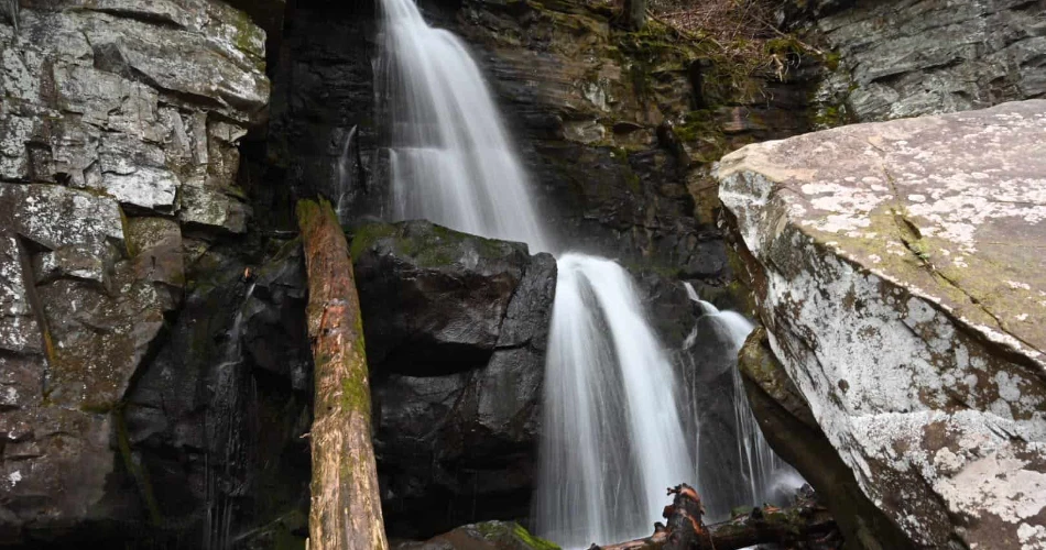
One of the best things about staying in Gatlinburg is that a good trail does not require spending half the day in the car. The northern entrance to Great Smoky Mountains National Park is right beside town, putting forests, streams, waterfalls, historic sites, and mountain scenery within easy reach. For visitors who want a proper walk in the woods without committing to a long drive, several trails around Sugarlands, the Gatlinburg entrance, Greenbrier, and Roaring Fork make excellent choices. Some are short enough for a relaxed morning, while others offer a few miles of hiking without sending travelers deep into the park.
This makes Gatlinburg a convenient base for travelers with different hiking preferences. A family looking for a gentle walk has very different needs from someone hoping to reach a waterfall or spend several hours on a forest trail. Some trails are ideal for a quick outing before lunch, while others can easily fill half a day. Visitors can also choose routes based on the season, weather, fitness level, and how much time they want to spend outdoors. With the right trail, it is possible to enjoy genuine Smoky Mountains scenery, flowing streams, old forest, and peaceful walking paths without turning the day into a long road trip.
The Gatlinburg Trail Is One of the Easiest Choices

For visitors who want hiking around Gatlinburg with minimal driving, the Gatlinburg Trail is one of the most practical places to begin. The trail starts at Sugarlands Visitor Center and follows the West Prong of the Little Pigeon River toward Gatlinburg. The round trip is approximately 4 miles, or about 6.4 kilometers. Much of the route is relatively wide and gently graded, although there are some steeper sections, roots, rocks, and uneven ground.
The setting changes gradually as the trail moves through cove hardwood forest. The river provides a constant companion, and walkers may notice old stone chimneys left from homes that once stood in the area. That historical detail makes the trail feel more interesting than a simple riverside walk.
Another useful feature is that the Gatlinburg Trail is one of only two trails in the national park where pets are permitted. Bicycles are also allowed. A parking tag is required when parking in the park for more than 15 minutes.
This is not the trail for someone searching for a dramatic summit or major elevation gain. Instead, it works particularly well when the goal is to stretch the legs, enjoy the river, and spend a few hours outdoors without committing to a difficult mountain hike.
Sugarlands Has Several Short Hikes Close Together
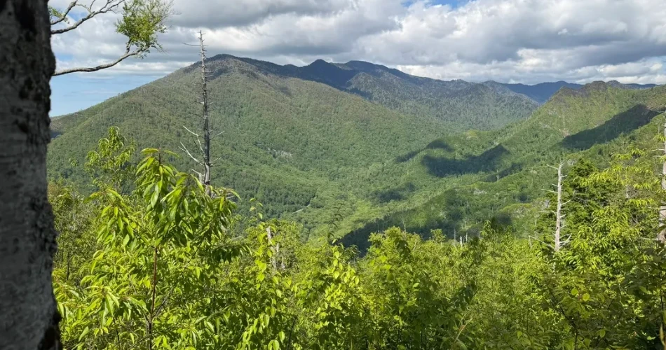
The Sugarlands area is especially useful for travelers comparing easy hikes in Gatlinburg because several different experiences can be reached from the same general area. The National Park Service describes Sugarlands as the northern gateway to the Smokies near Gatlinburg, with trails leading to streams, waterfalls, forests, and historic structures.
For a visitor who does not want a long drive, this area makes planning easier. A morning can begin with a short nature trail, followed by a waterfall walk, without needing to cross deep into the park. Sugarlands Visitor Center also provides a convenient place to ask rangers about current trail conditions, pick up a park map, and use restrooms before or after hiking.
The biggest advantage is flexibility. A traveler can choose a half-mile paved walk, a short waterfall hike, or a longer forest trail depending on energy levels. This is particularly helpful for groups where everyone does not have the same hiking ability.
The area can become busy, especially during summer and weekends, and parking at popular trailheads may fill quickly. The National Park Service specifically warns that parking can be limited at popular hiking destinations during peak visitation.
Cataract Falls
Cataract Falls is one of the simplest waterfall hikes for visitors searching for short hikes in Gatlinburg. The trail begins near Sugarlands Visitor Center and covers approximately 0.7 miles, or 1.1 kilometers, round trip. The destination is a narrow 40-foot waterfall along Fighting Creek.
The walk feels more like a forest outing than a strenuous hike. The trail follows Fighting Creek, crosses a large bridge, and then reaches the junction leading toward the falls. Along the way, the surroundings provide the kind of close-up Smoky Mountains scenery that can easily be missed from a car.
Cataract Falls can be especially attractive after rainfall because the water flow becomes more impressive. However, visitors should not climb on the rocks around the waterfall. The National Park Service reports that people have suffered serious injuries while climbing around the falls and recommends viewing and photographing the waterfall from the bottom.
For travelers with limited time, this is a strong option because the hike can fit comfortably into a morning or afternoon itinerary. It also pairs naturally with a stop at Sugarlands Visitor Center.
Sugarlands Valley Nature Trail
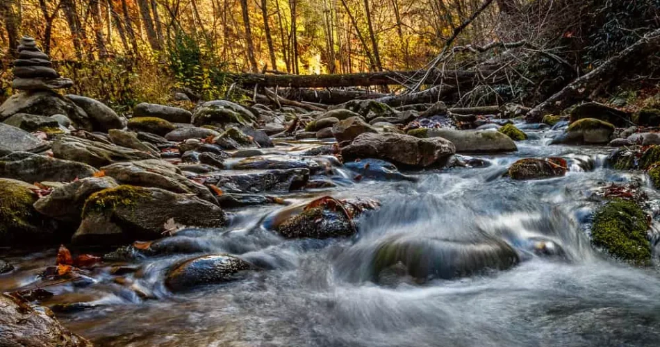
For an even gentler option, the Sugarlands Valley Nature Trail provides a half-mile, 0.8-kilometer loop on a paved and flat surface. The trail passes through cove hardwood forest and includes streamside scenery, rock walls, and historic stone chimneys.
This is currently the only trail in Great Smoky Mountains National Park that meets ADA accessibility standards, according to the National Park Service. The trail is fully paved and flat, making it a practical choice for visitors who cannot manage rocky or steep terrain.
The experience is deliberately simple. There is no major waterfall waiting at the end and no mountain summit to reach. Instead, the attraction is the chance to move slowly through the forest and pay attention to details such as the creek, trees, stone remains, and changing light.
It is also useful for families or groups that want a short outdoor activity rather than a demanding hike. Because the loop is only half a mile, visitors can enjoy it without setting aside several hours.
Fighting Creek Nature Trail

Fighting Creek Nature Trail adds a little more variety to a Sugarlands outing. The trail begins behind the visitor center and provides access to Cataract Falls. The National Park Service also describes a longer loop that passes the John Ownby cabin before returning toward the bridge area.
That historic connection gives the walk a different character. Instead of focusing only on scenery, hikers get a glimpse of how families once lived in the Smoky Mountains. Tree identification markers along the route also make the area useful for visitors interested in the forest itself rather than simply looking for a photo stop.
The trail works well for travelers who want to extend a short Cataract Falls visit. Rather than immediately returning to the car after seeing the waterfall, they can continue along the nature trail and spend more time among the trees.
For someone searching for Gatlinburg hiking trails that combine nature and history, this is a particularly sensible choice. It feels like a genuine Smoky Mountains walk without requiring the long drive associated with some of the park's more remote destinations.
Waterfall Hikes Can Still Be Close to Gatlinburg
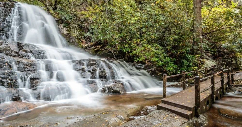
Waterfalls are among the biggest reasons people come to the Smokies, but reaching one does not always require a full-day excursion. Several waterfall trails are located relatively close to Gatlinburg, particularly around Sugarlands and Roaring Fork. The important difference is that "close" does not always mean easy. Some short waterfall hikes still involve roots, rocks, inclines, and slippery surfaces.
Cataract Falls is the easiest example, but Grotto Falls provides a more substantial outing. It takes hikers along the Trillium Gap Trail through forest and across several streams before reaching a 25-foot waterfall. The trail continues behind the falls, creating one of the more unusual waterfall experiences in the park.
Visitors should plan around parking as well as hiking distance. The Grotto Falls trailhead has limited parking and often fills, particularly during busy periods. The National Park Service recommends having a backup plan or considering a shuttle.
The advantage of choosing a nearby waterfall is that the rest of the day remains flexible. A traveler can hike in the morning, return to Gatlinburg for lunch, and still have time for another activity. That makes these trails particularly useful for shorter vacations when every hour matters.
Grotto Falls
Grotto Falls is one of the better choices for visitors who want Smoky Mountains hiking with a memorable destination but do not want to drive far from Gatlinburg. The trailhead is reached from the Roaring Fork Motor Nature Trail, which begins near Gatlinburg. From the Trillium Gap Trailhead, the hike to Grotto Falls and back is approximately 2.6 miles, or 4.2 kilometers.
The trail passes through a cool mountain forest, crosses streams, and moves through areas of rhododendron and older forest growth. The waterfall itself is 25 feet high, but its most distinctive feature is the trail that passes behind it. That allows hikers to experience the falls from a perspective that is unusual compared with most waterfalls in the park.
The route is not completely effortless. Roots, rocks, inclines, and wet conditions can make sections slippery. After heavy rainfall, stream crossings and muddy sections deserve additional attention.
The short driving approach is a major advantage, but parking is the catch. The trailhead has limited spaces and can fill quickly. Visitors who arrive late should be prepared to change plans rather than wait indefinitely for a parking space.
Porters Creek Adds Forest, Water and History
Travelers willing to make a slightly longer local drive can consider the Greenbrier area and Porters Creek Trail. It is still a practical choice for people staying around Gatlinburg who want hiking near Gatlinburg without committing to one of the park's distant mountain destinations.
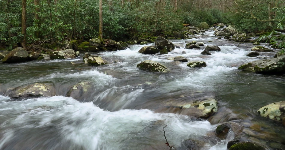
Porters Creek combines several things that make a Smoky Mountains hike rewarding: flowing water, forest scenery, wildflowers in season, historic remnants, and a waterfall. The National Park Service describes it as a peaceful moderate trail with both historical and natural features.
The trailhead is at the end of Greenbrier Road, where a gravel parking area has room for approximately 20 vehicles. Parking is therefore more limited than the number of hikers who may want to use the trail on a busy day. A parking tag is required.
Hikers can turn around after reaching Fern Branch Falls, which is roughly two miles into the hike. The 40-foot waterfall provides a natural stopping point, while those continuing farther should expect a steeper, mostly uphill section toward the backcountry campsite. Camping there requires a backcountry permit.
For a traveler who wants a fuller hiking experience without spending the entire day driving, Porters Creek offers a good middle ground. It feels more remote than the shortest Sugarlands walks while remaining manageable as a day trip from Gatlinburg.
Roaring Fork Offers More Than Just a Drive
Roaring Fork is another excellent choice when the goal is to combine a short drive with several opportunities to stop and walk. The Roaring Fork Motor Nature Trail begins from Gatlinburg and follows a one-way route through forested mountain scenery. The National Park Service notes that the entrance is accessed from Historic Nature Trail Road near the Cherokee Orchard area.
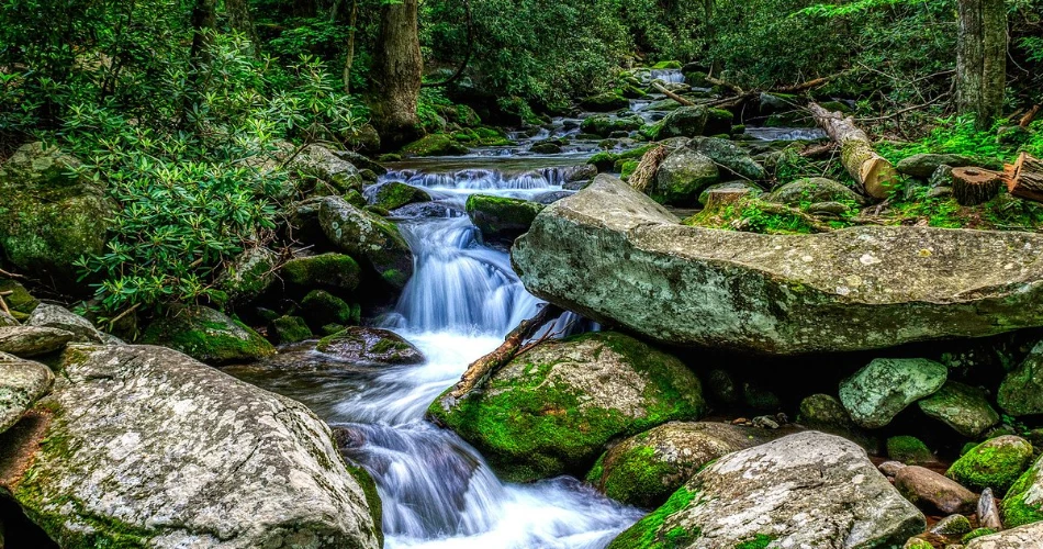
The road itself is part of the experience. Historic buildings, streams, forest scenery, and roadside waterfalls make it possible to enjoy the area even when everyone in the group does not want to hike.
For hikers, the Trillium Gap Trail provides access to Grotto Falls. The trailhead appears about two miles into the Roaring Fork route, but parking there is limited.
The road is seasonal. According to the current National Park Service schedule, Roaring Fork Motor Nature Trail is listed as open from April 17 through November 29, 2026, subject to closures and conditions. It is a one-way, very steep road, and larger vehicles are restricted.
That makes Roaring Fork best suited to travelers who want their outing to include both driving and walking. Instead of driving a long distance solely to reach a trailhead, visitors can turn the approach itself into part of the Smoky Mountains experience.
Choose the Trail Based on the Kind of Day
Not every visitor looking for Gatlinburg hiking trails wants the same thing. Someone with only an hour before dinner needs a different trail from a traveler planning a half-day outdoors. Fortunately, the area around Gatlinburg offers enough variety to match different schedules.
For the shortest outing, Sugarlands Valley Nature Trail is hard to beat. Its half-mile paved loop provides forest and stream scenery without the physical demands of a mountain trail. Cataract Falls is another excellent choice when a waterfall is more important than distance.
For a relaxed but longer walk, the Gatlinburg Trail offers approximately four miles round trip and stays relatively broad and gentle for much of its route. It also follows the river, giving the hike a strong sense of place.
For visitors wanting a more traditional hiking experience, Grotto Falls and Porters Creek are better choices. Both involve more uneven terrain and require more time, but they also provide stronger destination rewards.
The decision can also depend on weather. Wet conditions can make rocks, roots, and stream crossings more difficult. A short paved trail may therefore be a better choice on a rainy day than a waterfall hike with uneven terrain.
The Best Activities for a Short Hiking Day
A short hiking trip around Gatlinburg does not have to mean rushing through a trail and immediately returning to town. Several nearby areas lend themselves to combining hiking with other simple outdoor activities.
One option is waterfall viewing. Cataract Falls requires only a short round trip from Sugarlands Visitor Center, while Grotto Falls provides a longer outing with the unusual opportunity to walk behind the waterfall. Both give visitors a clear destination rather than simply walking a loop.
Another good activity is river and forest walking. The Gatlinburg Trail follows the river and provides a quieter setting away from some of the busiest roads. Because pets and bicycles are permitted on this trail, it can also work for visitors looking for a more flexible outdoor outing.
A third option is history-focused hiking. The Sugarlands trails include historic stone chimneys and the John Ownby cabin area, while Porters Creek includes historic structures and the Great Smoky Mountains Hiking Club Cabin.
These combinations make nearby trails particularly useful for travelers who do not want every vacation day to revolve around a difficult hike. A short trail can be followed by a scenic drive, picnic, visitor-center stop, or return to Gatlinburg.
Practical Details Before Setting Out
A little preparation makes hiking around Gatlinburg much easier, especially during busy seasons. First, visitors should check the National Park Service's current conditions before leaving. Trails and roads can close because of construction, weather, maintenance, or other safety concerns.
One particularly important current update concerns Laurel Falls. As of August 2026, the Laurel Falls Trail remains closed for major rehabilitation work. The National Park Service states that the closure began January 6, 2025, and covers the trail from Fighting Creek Gap Road to the junction with Little Greenbrier and Cove Mountain trails.
A parking tag is required when visitors park in the national park for more than 15 minutes. Trailhead parking can also become a genuine issue at popular destinations, especially on summer weekends. Arriving earlier generally gives hikers more flexibility.
Good footwear matters even on shorter trails. Roots, rocks, wet leaves, and mud can appear unexpectedly, particularly after rain. Water should be carried even on short hikes, and weather should be checked before heading into the mountains.
Finally, visitors should avoid treating a nearby trail as automatically easy. Distance is only one measure of difficulty. Terrain, elevation, weather, water crossings, and trail conditions can all change how demanding a walk feels.
A Nearby Trail Can Be the Better Choice
The biggest advantage of hiking around Gatlinburg is not simply convenience. Staying close to town gives travelers more freedom to choose a trail based on the weather, available time, and energy level rather than committing to a long drive before the hike even begins.
Sugarlands is particularly useful for short outings, with Cataract Falls, Sugarlands Valley Nature Trail, and the Gatlinburg Trail all offering different experiences. Roaring Fork adds waterfall hiking and historic scenery without requiring a lengthy journey from Gatlinburg. Greenbrier and Porters Creek provide a more substantial forest experience for hikers who want something quieter and longer.
There is also a practical benefit to keeping the drive short: the hiking day becomes less rigid. If a trailhead is crowded, the weather changes, or the group decides that a shorter walk is enough, another nearby option can be chosen.
That flexibility is valuable in the Smokies. The mountains are not going anywhere, and a satisfying hiking day does not have to involve the longest trail or the most distant trailhead. Sometimes the better experience is simply parking the car, walking into the forest, listening to the water, and having enough time left in the day to enjoy Gatlinburg afterward.
Next post Beautiful Trails Near Gatlinburg for First-Time Hikers
Previous Post Scenic Hiking Trails to Explore Near Gatlinburg
About Author
