 English

 Home
Home Hotels
  Car Rental
 Rewards
 Travel Guide
Beautiful Places to Explore in and Around Gatlinburg

Gatlinburg can be loud, colorful, and busy along the Parkway, but it takes surprisingly little time to find a completely different side of the destination. Forest roads begin near downtown, mountain streams tumble through shaded valleys, and overlooks open onto layer after layer of the Great Smoky Mountains. That contrast is one of the best reasons to spend more than a quick afternoon here. A traveler can watch the city wake up, walk beside a waterfall before lunch, follow a winding mountain road in the afternoon, and finish the day looking across the Smokies from high above town. Many of the most beautiful places around Gatlinburg are also easy to combine into a realistic itinerary. Some require hiking, while others are reached by scenic road, gondola, chairlift, or a short walk. First-time visitors can see classic Gatlinburg scenic spots without attempting long backcountry hikes, while returning travelers can move beyond the busiest stops and spend more time in forests, craft communities, and quieter corners of the national park.
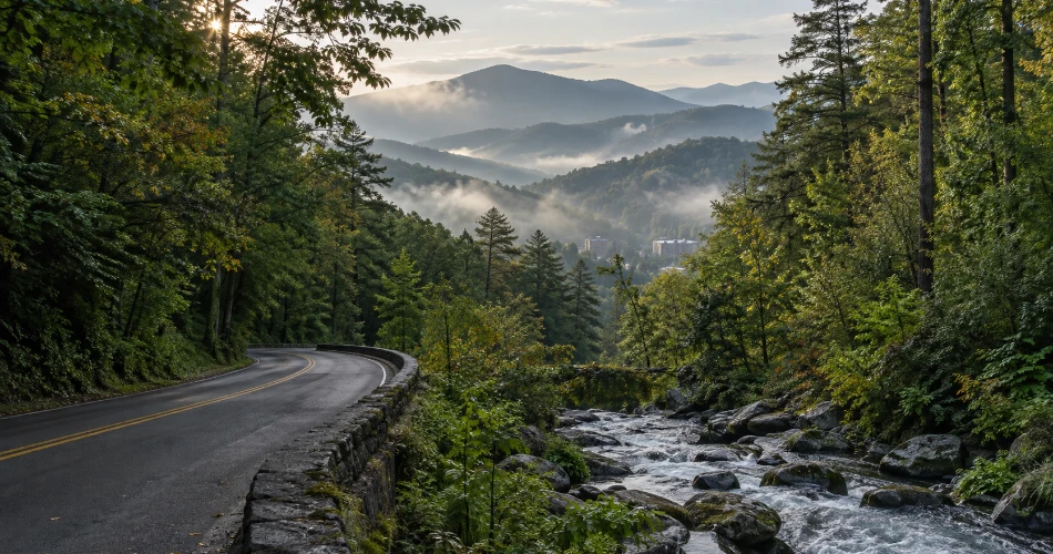
Start With the Great Smoky Mountains Just Beyond Downtown
The most important thing to understand about Gatlinburg is how close it sits to Great Smoky Mountains National Park. Sugarlands, one of the park's main northern gateways, is only about two miles south of Gatlinburg, so travelers do not have to spend an hour in the car before the scenery changes. Sugarlands Visitor Center is useful for maps, ranger information, natural-history exhibits, restrooms, and current advice about roads and trails.
From there, the park quickly becomes quieter. Fighting Creek runs through thick woodland, short paths slip beneath mature trees, and larger mountain roads lead deeper toward high country. This is one of the easiest areas for first-time visitors looking for things to do in Gatlinburg that feel genuinely connected to the Smokies rather than simply adjacent to them.
A useful first stop is the short walk to Cataract Falls. The official park route is about 0.7 mile round trip and ends at a narrow, approximately 40-foot waterfall. It is especially attractive after rain, when more water moves over the rock face. Visitors should stay at the designated viewing area rather than climbing around the falls, where wet rock has caused serious accidents.
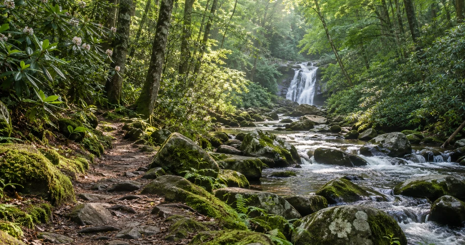
Take the Short Walk to Cataract Falls
Cataract Falls works particularly well for travelers who want woodland scenery without committing to a half-day hike. The route begins near Sugarlands Visitor Center and follows a forested corridor beside Fighting Creek before reaching the waterfall. Because the outing is short, it can be fitted into an arrival day, combined with Newfound Gap Road, or used as a gentle first walk before attempting longer trails later in the trip. The National Park Service describes the waterfall as roughly 40 feet high and notes that it becomes more dramatic after heavy rainfall.
The appeal is not simply the waterfall itself. The walk introduces visitors to the humid, green character of lower-elevation Smoky Mountain forest. Roots cross the ground, small streams appear between trees, and changing light filters through the canopy. In autumn, fallen leaves add warm color to the trail; in spring and summer, the setting becomes deeply green.
Travelers should resist the temptation to scramble above or beside the falls for photographs. The park specifically restricts climbing around Cataract Falls because slick rock has resulted in injuries. A photograph from the bottom provides the safer—and often better—view.

Drive Higher to Newfound Gap and Kuwohi
For classic Smoky Mountain views, Newfound Gap Road is difficult to beat. US 441 climbs from the Gatlinburg side of the national park toward the Tennessee–North Carolina line, gaining elevation as the forest gradually changes. Newfound Gap itself sits at 5,046 feet and is the lowest drivable gap through Great Smoky Mountains National Park. Conditions can be noticeably cooler there than in Gatlinburg, and rain in the lower elevations can occasionally become snow at the gap, so carrying an extra layer makes sense even outside winter.
From Newfound Gap, travelers can continue toward Kuwohi, formerly known as Clingmans Dome. Kuwohi is the highest peak in the Smokies, and a road from Newfound Gap leads toward the high-elevation visitor area and observation tower. The surrounding spruce-fir forest feels dramatically different from downtown Gatlinburg.
Weather can hide distant ridges completely, but that is part of the character of the Smokies. On clear days, the layered mountain panorama is immense; on misty days, the landscape becomes quieter and moodier. Because Kuwohi facilities and road access are seasonal, travelers should verify conditions before setting out.

Take the Slow Road Through Roaring Fork
Roaring Fork Motor Nature Trail offers one of the best examples of how quickly Gatlinburg's busy atmosphere can disappear. Reached from the Historic Nature Trail Road area, the 5.5-mile one-way loop winds through dense forest beside Roaring Fork, one of the faster-flowing mountain streams in this part of the park. The road is narrow and deliberately slow, which suits the landscape. Travelers are more likely to remember the sound of moving water, old trees leaning toward the roadway, and historic buildings tucked into clearings than the number of miles covered.
Several stops encourage visitors to get out of the car. Near the approach to the motor trail, the Noah “Bud” Ogle area preserves a historic mountain farmstead. Farther along, trails branch toward waterfalls and forest destinations. Near the end of the loop, the aptly named Place of a Thousand Drips sends water over a roadside rock face, particularly impressively after rain.
Drivers need to plan carefully because the route is seasonal, parking near popular trailheads can fill quickly, and buses, trailers, and motor homes are not permitted on the motor nature trail. This is a road for unhurried sightseeing rather than rushing from one attraction to another.

See Gatlinburg From Above at SkyPark
Not every beautiful Gatlinburg viewpoint requires a mountain hike. Gatlinburg SkyPark provides an elevated look across town toward Great Smoky Mountains National Park, making it particularly useful for travelers who want broad Smoky Mountain views without spending several hours on a trail. The experience begins with the yellow SkyLift, which climbs from the Parkway to Crockett Summit. At the top, viewpoints look back across Gatlinburg and toward the mountains beyond.
The SkyBridge is the feature most visitors recognize, but the scenery is the real reason to stay rather than simply crossing and heading straight back down. The bridge and summit areas give travelers different perspectives on the steep terrain surrounding Gatlinburg. Clayton's Landing adds another overlook, while walking areas around the summit make it possible to slow down and watch the changing light across the ridges.
Late afternoon can be especially atmospheric as mountain shadows lengthen and downtown begins to brighten below. Autumn brings a completely different palette, with wooded slopes turning red, orange, rust, and gold.
Because operations are weather dependent and ticket details can change, visitors should check current conditions before arriving.

Spend an Unhurried Mountain Day at Anakeesta
Anakeesta is another of the better-known Gatlinburg attractions, but it works best when treated as a place to linger rather than a quick ride to the top. The mountaintop park rises about 600 feet above downtown and covers more than 90 acres of Smoky Mountain forest. Its combination of garden paths, observation points, suspended walkways, and mountain scenery makes it especially appealing when a group includes travelers with different activity levels.
The AnaVista observation tower offers 360-degree views, while Vista Gardens provides a slower experience among landscaped paths and overlooks. The Treetop Skywalk moves visitors into the forest canopy through a network of elevated bridges. Anakeesta's 2026 expansion also introduced the Crystal Express gondola, reworked Firefly Village, and an expanded Treetop Skywalk.
Some guests head straight toward the more active attractions, but travelers interested in scenery should leave time for the quieter corners. Mountain conditions change constantly: ridges that are sharp at midday may vanish into haze an hour later.
A practical approach is to arrive with enough time to see the mountain in daylight and then remain as evening approaches. The shift from forest views to glowing Gatlinburg lights gives the same location two very different moods.

Follow the Great Smoky Arts & Crafts Community
Some of the most interesting places around Gatlinburg are beautiful for reasons other than mountain height. The Great Smoky Arts & Crafts Community stretches along an eight-mile loop in the Glades area and brings together studios, galleries, workshops, and locally made crafts. More than 100 artists and craftspeople are represented along the route, with work ranging from pottery and painting to woodcarving, leatherwork, baskets, quilts, candles, and musical instruments.
The loop rewards slower travel. Rather than trying to visit every workshop, travelers can choose several that genuinely interest them and allow enough time to talk with makers or watch a craft process when demonstrations are available. The surroundings also feel noticeably calmer than central Gatlinburg, with tree-lined roads and buildings spread across a more rural landscape.
This area provides useful cultural context for a Smoky Mountains trip. Appalachian craft traditions are not merely decoration for tourism; skills involving wood, clay, textiles, and music have long histories in the region.
A relaxed visit might include:
- Watching a potter or woodworker at work when demonstrations are offered.
- Choosing locally made pieces rather than mass-produced souvenirs.
- Driving the full loop slowly instead of treating it as a single shopping stop.

Make Time for Greenbrier's Forest and River Scenery
Greenbrier sits roughly 20 minutes east of Gatlinburg and provides a different feel from the high overlooks around Newfound Gap or the activity of downtown. The National Park Service describes it as a heavily forested cove in the northeastern portion of Great Smoky Mountains National Park. Here, the scenery is closer and more intimate: river rocks, rushing water, deep forest, and mountain slopes rising around the valley.
This is a good choice for returning visitors who have already seen the most famous Gatlinburg scenic spots and want a landscape that feels less focused on grand overlooks. Roadside pull-offs and trail access make it possible to build anything from a short scenic outing to a longer hiking day, depending on current access and trail conditions.
Greenbrier is particularly photogenic after rainfall, when streams run strongly and moss seems to brighten across rocks and tree trunks. Spring brings fresh foliage and wildflowers, while autumn gives the valley a more muted mixture of yellow, bronze, and orange.
As in every part of the national park, travelers should confirm road and trail conditions before leaving Gatlinburg. Mountain weather, maintenance work, and seasonal closures can quickly change what is accessible.

Know the Practical Details Before Heading Into the Smokies
Beautiful scenery is easier to enjoy when basic logistics are handled before leaving town. Great Smoky Mountains National Park does not charge a general entrance fee, but vehicles parked inside the park for more than 15 minutes generally need a valid parking tag. Current prices are $5 for a daily tag, $15 for a weekly tag, and $40 for an annual tag. Purchasing a tag does not reserve or guarantee a parking space.
That distinction matters at popular locations such as Kuwohi, waterfall trailheads, and Roaring Fork, where demand can exceed available parking. Travelers should avoid creating unofficial spaces along road shoulders and have an alternate stop in mind when a lot is full.
A few habits make sightseeing considerably smoother:
- Begin popular drives and walks earlier in the day when possible.
- Carry layers because high elevations can be much cooler than downtown Gatlinburg.
- Check official road, weather, and trail updates before entering the park.
- Keep wildlife at a safe distance and never block traffic for photographs.
One especially important 2026 update concerns Laurel Falls Trail. Despite older guides continuing to recommend it, the trail remains closed for rehabilitation, and current park information anticipates reopening sometime in 2027.
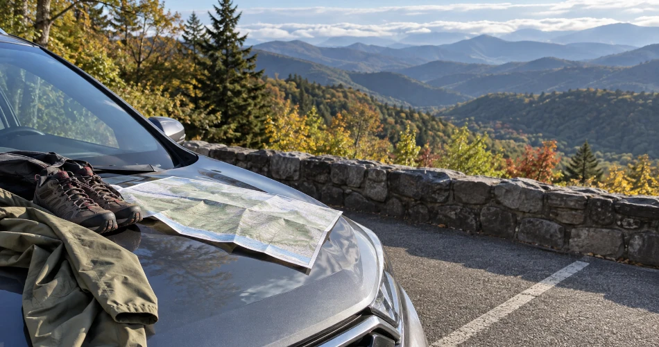
Let Gatlinburg Be More Than a Checklist
The strongest Gatlinburg trips usually include a mix of famous viewpoints and places where nothing dramatic needs to happen. A morning beside Fighting Creek, a slow drive through Roaring Fork, an hour watching clouds move across Newfound Gap, or an afternoon talking with craftspeople can be as memorable as any headline attraction. That balance is what gives beautiful places around Gatlinburg their range.
First-time visitors can begin with Sugarlands, Newfound Gap, Kuwohi, and one elevated town viewpoint. Those returning to the area can spend more time in Greenbrier, the Arts & Crafts Community, or lesser-rushed stretches of the national park. Families can combine short walks with mountain attractions, while photographers can plan around early morning mist, changing autumn color, flowing water after rain, and late-day light on the ridgelines.
There is also no need to force every Gatlinburg attraction into a single trip. The Great Smoky Mountains cover more than half a million acres across Tennessee and North Carolina, meaning this region rewards repeated visits far more than hurried sightseeing.
The best plan leaves room for the mountains to change it.
Next post What to See First When You Arrive in Gatlinburg
Previous Post A Day of Sightseeing Around Gatlinburg
About Author
