 English

 Home
Home Hotels
  Car Rental
 Rewards
 Travel Guide
Mountain Trails Around Gatlinburg Worth Exploring


Gatlinburg sits right beside one of the best hiking landscapes in the eastern United States, with the mountains of Great Smoky Mountains National Park beginning almost at the edge of town. That makes it possible to spend a morning walking beside a rushing stream, climb toward a high-elevation viewpoint by afternoon, and still be back in Gatlinburg before dinner. The best mountain trails around Gatlinburg are not all alike. Some are relatively short and rewarding, while others demand several hours of steady climbing. Alum Cave Bluffs, Chimney Tops, Rainbow Falls, Charlies Bunion, Andrews Bald, and Mount Le Conte each offer a different view of the Smokies. The scenery also changes noticeably with elevation, from hardwood forests near town to spruce-fir forests and open mountain balds higher up. For visitors planning a hiking trip, understanding the trail length, terrain, parking situation, and current conditions can make the difference between an enjoyable day outside and an unnecessarily difficult one.
Why Gatlinburg Is a Great Base for Mountain Hiking
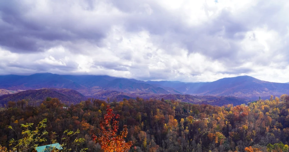
Gatlinburg works particularly well as a base for hikers because several major trailheads in Great Smoky Mountains National Park are reached by roads leading directly from town. Sugarlands Visitor Center is only a short drive from central Gatlinburg, while Cherokee Orchard Road provides access toward Rainbow Falls and the Roaring Fork area. Newfound Gap Road, or US 441, climbs from the Gatlinburg side into the higher elevations of the park and provides access to trails such as Chimney Tops, Alum Cave, Charlies Bunion, and Andrews Bald farther along the route. This variety means visitors do not have to commit to one type of hiking experience.
The mountain landscape changes quickly as the elevation rises. The park ranges from 876 feet to 6,643 feet, and Mount Le Conte reaches 6,593 feet. Higher trails can feel considerably cooler than Gatlinburg, particularly outside summer.
Another advantage is choice. Someone looking for a manageable morning hike can choose a shorter route, while experienced hikers can spend most of a day climbing toward Mount Le Conte. The important point is not to judge a trail solely by its mileage. Steep climbs, exposed rocks, stairs, changing weather, and elevation gain can make a relatively short Smoky Mountain hike surprisingly demanding. Checking the National Park Service conditions before leaving is therefore part of planning, not an optional extra.
Alum Cave Bluffs Is One of the Most Rewarding Shorter Mountain Hikes

For visitors who want a genuine mountain hike without committing to a full-day trek, Alum Cave Bluffs is one of the strongest choices near Gatlinburg. The trail travels through old-growth forest, crosses mountain streams, passes Arch Rock, and eventually reaches the broad rock overhang known as Alum Cave Bluffs. The round trip to the bluffs is 4.6 miles, and the trailhead is on Newfound Gap Road between mile markers 10 and 11.
The character of the hike changes as it progresses. The first portion feels like a traditional Smokies forest walk, with trees surrounding the trail and water frequently audible nearby. Arch Rock is one of the memorable features along the route, and reaching it gives hikers an early sense of the geological character of the area. Beyond Arch Rock, the trail becomes noticeably steeper. Stairs, roots, rocks, and uneven sections require more attention, particularly when the surface is wet.
Reaching Alum Cave Bluffs
The bluffs themselves provide a natural stopping point. The huge overhang gives hikers a place to pause while looking across the surrounding forest and mountain slopes. The area is particularly impressive when clouds or mist move through the ridges, although wet conditions also make the trail more slippery.
For stronger hikers, Alum Cave is also the beginning of a much longer adventure. Continuing beyond the bluffs toward Mount Le Conte turns the outing into a 10-mile round trip. The National Park Service describes the Mount Le Conte route as steep and rocky, so hikers should treat it as a serious full-day mountain hike rather than simply an extension of a casual walk.
Because Alum Cave is extremely popular, parking can fill quickly. The trailhead has limited parking, and the park recommends considering a shuttle during busy periods. A parking tag is required for vehicles parked longer than 15 minutes inside the park.
Chimney Tops Delivers a Short, Steep Hike With Big Views
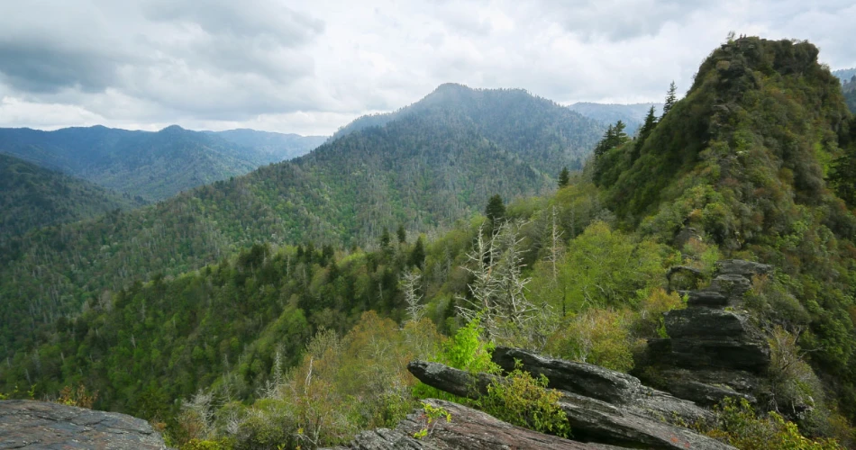
Chimney Tops is the kind of trail that can look deceptively manageable on a map. The current hike to the official Chimney Tops Overlook is 3.5 miles round trip, but the route includes steep inclines, stairs, bridges, roots, rocks, and a significant climb. The trailhead sits on Newfound Gap Road, roughly seven miles from Sugarlands Visitor Center.
The Climb to Chimney Tops Overlook
The first part of the trail introduces hikers to the forest and several stream crossings. The steady climbing becomes more obvious as the route continues, and stone steps make some sections feel more like a staircase than a conventional woodland path. That effort is worthwhile when the trees begin to open around the overlook.
It is important to understand what the current trail actually offers. The uppermost section leading to the rocky pinnacles is closed. The National Park Service has placed a closure structure at the designated point, and visitors should not climb beyond it. The closure relates to safety and environmental concerns following damage from the 2016 Chimney Tops wildfire.
What Makes the Hike Worthwhile
Even without reaching the closed pinnacles, the overlook provides a satisfying mountain experience. The landscape itself tells part of the story: sections of the forest show the effects of the wildfire while newer vegetation has developed around them. It is a useful reminder that the Smokies are an evolving ecosystem rather than a landscape frozen in time.
Chimney Tops is best suited to hikers who are comfortable with steep terrain and want a relatively compact challenge. It can be tiring despite its modest mileage, so visitors should not schedule it as an effortless sightseeing stop. Parking is also limited, with the park listing 34 spaces at the trailhead and recommending shuttles during busy periods.
Rainbow Falls Combines a Waterfall With a Serious Mountain Climb
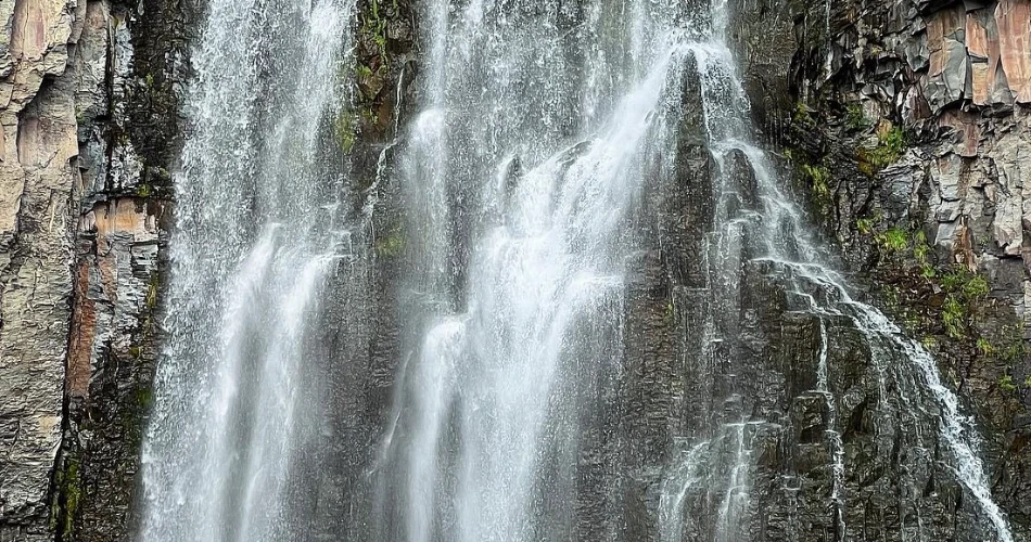
Rainbow Falls offers a different experience from Chimney Tops because the main destination is a waterfall rather than an overlook. The 5.6-mile round-trip hike follows a varied forest landscape to a waterfall where mist can create a rainbow effect near the base on sunny afternoons. The trail gains approximately 1,500 feet in elevation, making it a moderately strenuous to strenuous outing depending on pace and conditions.
The Walk to Rainbow Falls
The trail begins from Cherokee Orchard Road and moves through forest alongside mountain streams. The sound of water becomes part of the experience, especially after periods of rain. Old-growth trees appear along portions of the route, while other areas show scars from the 2016 fire.
The climb is gradual but persistent. Hikers who are expecting a flat walk to a waterfall can underestimate the effort required to return, since the route involves substantial elevation gain. Sturdy footwear and enough water are sensible choices, particularly during warmer months.
Continuing Toward Mount Le Conte
Rainbow Falls is also connected to the Mount Le Conte trail network. Hikers continuing beyond the waterfall can travel toward Mount Le Conte, creating a 13-mile round trip from the Rainbow Falls Trailhead. The route passes through additional trail junctions before reaching the summit area, where Mount Le Conte rises to 6,593 feet.
For most visitors, however, Rainbow Falls itself is a satisfying destination. The waterfall gives the hike a clear goal while the climbing provides a genuine mountain workout. The trailhead can become extremely crowded, and the National Park Service warns that parking is limited. There are pit toilets at the trailhead, but visitors should not expect extensive facilities once they begin hiking.
Charlies Bunion Is a Strong Choice for High-Elevation Mountain Views

Charlies Bunion is particularly appealing to hikers who want the feeling of being deep in the mountains rather than simply walking through a forest close to Gatlinburg. The trail follows an eight-mile round-trip section of the Appalachian Trail from Newfound Gap. It passes through hardwood and high-elevation spruce-fir forest before reaching a distinctive rocky outcrop surrounded by steep slopes.
Hiking From Newfound Gap
The trail begins at the Appalachian Trailhead near the Newfound Gap Overlook. The route is generally wide and firm in its earlier sections, but it includes climbing, roots, rocks, and narrower terrain as it progresses. The higher elevation makes the environment noticeably different from trails closer to Gatlinburg.
Charlies Bunion itself is a distinctive rock formation created through erosion after an early-1900s wildfire exposed the underlying landscape. Its unusual name is associated with Appalachian Trail supervisor Charlie Conner and an old story about his worn footwear.
Why Experienced Hikers Like It
The appeal is less about one dramatic waterfall or structure and more about the journey. Mountain ridges, changing forests, and long-distance views make the hike feel expansive. The trail also gives visitors an opportunity to experience a section of the Appalachian Trail without undertaking a multi-state backpacking trip.
The exposed areas around the rocky outcrop require caution. The National Park Service specifically advises care around cliffs, while winter conditions can bring ice to the route. Microspikes may be appropriate during icy conditions.
Newfound Gap is also a busy destination, and parking is first come, first served. The park recommends considering a shuttle for popular trailheads. A parking tag is required for vehicles parked longer than 15 minutes.
Andrews Bald Offers a Different Side of the Smokies
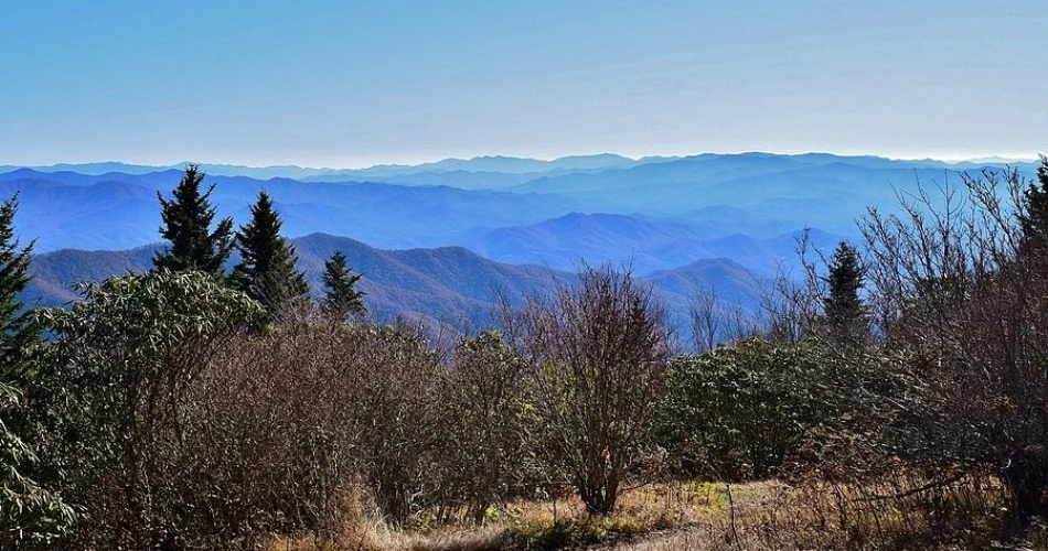
Andrews Bald is a good option for travelers who want mountain scenery without taking on one of the longest hikes in the area. The trail is 3.6 miles round trip from the Forney Ridge Trailhead near the Kuwohi parking area. Rather than climbing continuously from low elevation, hikers begin high in the Smokies and descend toward the grassy bald before making the climb back.
Walking Through High-Elevation Forest
The route follows the Forney Ridge Trail through spruce-fir forest. The first section includes numerous stairs, after which the trail becomes a narrower dirt path. The outward journey is largely downhill, which can create a false sense of ease. The return requires a steady uphill climb, and that final ascent can feel much harder after several miles of hiking.
Andrews Bald is known for its open grassy landscape and surrounding mountain views. During summer, flowering azaleas can add color to the scene, while high-elevation birds such as dark-eyed juncos may be seen along the trail.
When Andrews Bald Works Best
This trail works particularly well for visitors who want scenic mountain hiking without committing to the eight- or ten-mile routes found elsewhere in the park. Its high elevation also means conditions can differ substantially from Gatlinburg. Spring weather in the Smokies can change rapidly, and snow can still occur at higher elevations during March.
Andrews Bald can become crowded because the same area provides access to Kuwohi, formerly known as Clingmans Dome. Visitors should plan for limited parking and consider arriving early or arranging a shuttle when available. The combination of a manageable distance, high-elevation forest, and an open mountain destination makes this one of the more distinctive scenic hikes in Gatlinburg’s surrounding area.
Mount Le Conte Routes Suit Hikers Looking for a Full-Day Challenge
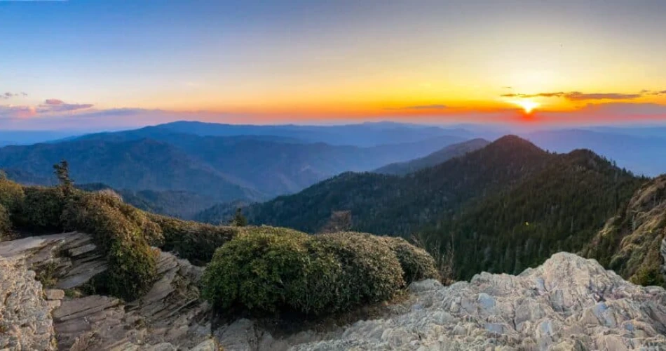
Mount Le Conte is one of the defining hiking destinations in the Smokies, but there is no single route to the summit. Several trails approach the mountain from different directions, and the mileage varies considerably. Alum Cave provides a 10-mile round trip, while Rainbow Falls and Trillium Gap routes are about 13 miles round trip. The Bullhead route is 13.6 miles round trip.
The mountain reaches 6,593 feet, making it the third-highest peak in Great Smoky Mountains National Park. Reaching the summit is therefore a substantial undertaking rather than an ordinary afternoon walk.
Choosing a Route to Mount Le Conte
Alum Cave is the shortest of the commonly used routes, but it is steep and rocky. Rainbow Falls adds a waterfall to the journey and provides a longer approach. Bullhead offers another long ascent and can provide consistent mountain views, although its lack of shade in some areas makes hot-weather hiking more demanding.
The National Park Service currently notes a temporary schedule affecting Bullhead Trail: it is closed Monday through Thursday, excluding federal holidays, through November 19, 2026, while rehabilitation work continues. Visitors planning this route should therefore check conditions immediately before the hike.
Mount Le Conte rewards hikers with high-elevation scenery and viewpoints including Cliff Top and Myrtle Point. The journey itself is a major part of the experience, moving through several forest environments as elevation changes. Anyone attempting the summit should start early, carry adequate water and food, and leave enough daylight for the return trip.
A Few Practical Details Make Gatlinburg Hiking Much Easier

The difference between a good hiking day and a frustrating one often comes down to preparation. Popular Gatlinburg hiking trails can have crowded parking areas, and a parking tag is required for vehicles parked in the national park for more than 15 minutes. Current rates listed by the National Park Service are $5 for a daily tag, $15 for a weekly tag, and $40 for an annual tag. The tag does not reserve or guarantee a parking space.
Check Conditions Before Leaving
Trail conditions can change because of storms, fallen trees, ice, construction, wildfire impacts, or rehabilitation projects. The park's current conditions page should be checked on the day of a hike. As of August 2026, Laurel Falls remains closed for rehabilitation, while Bullhead has the weekday rehabilitation closure described above.
Weather deserves equal attention. Summer brings heat, humidity, and frequent afternoon showers and thunderstorms at lower elevations. Higher elevations can be considerably cooler. Spring weather can change quickly, and winter hikers may encounter ice even when conditions in Gatlinburg seem mild.
Plan Around Parking and Trail Length
Popular trailheads such as Alum Cave, Chimney Tops, and Rainbow Falls have limited parking. The National Park Service recommends using authorized shuttle services when appropriate, particularly during busy periods.
Hikers should also remember that cell service can be unreliable in the mountains. A downloaded map, water, food, weather-appropriate clothing, and a realistic turnaround time are more useful than relying on a phone signal. For longer Smoky Mountain hikes, starting earlier generally provides more time to handle slow sections, breaks, and unexpected changes in weather.
Picking the Right Trail for the Day
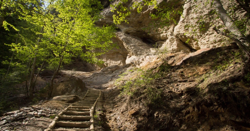
The best mountain trails around Gatlinburg depend heavily on what kind of day a visitor wants. Alum Cave Bluffs is a strong middle-ground choice, combining geological features, streams, forest scenery, and a memorable destination within 4.6 miles round trip. Chimney Tops is shorter at 3.5 miles but feels much steeper and more strenuous because of the climb.
Rainbow Falls suits hikers who enjoy waterfalls and do not mind sustained climbing, while Charlies Bunion is better for those who want high-elevation Appalachian Trail scenery and panoramic mountain views. Andrews Bald provides a shorter high-elevation outing with an open grassy destination, although the return climb should not be underestimated.
For experienced hikers with a full day available, Mount Le Conte provides a much bigger challenge. The different routes allow hikers to choose between waterfalls, rock formations, forests, and long mountain climbs.
A sensible approach is to match the trail to the group's fitness, available daylight, weather, and experience rather than choosing solely because a particular viewpoint appears in photographs. The Smokies can be surprisingly demanding, and a shorter hike completed comfortably is often more enjoyable than a longer route that leaves everyone exhausted.
Planning a Mountain Hiking Day From Gatlinburg
A good hiking day around Gatlinburg starts before reaching the trailhead. Visitors should check the National Park Service conditions page, look at the weather for both Gatlinburg and the higher elevations, confirm whether the selected trail is open, and arrange parking or shuttle transportation when necessary. This is especially important for popular routes where parking can fill early.
The mountain trails around Gatlinburg also reward travelers who allow time to slow down. Streams, changing forest types, wildflowers, distant ridges, and shifting weather are part of the experience, not simply scenery between trail markers. Hikers should stay on designated routes, respect closures, avoid approaching exposed edges, and carry out everything they bring in.
For first-time visitors, Alum Cave Bluffs or Andrews Bald can provide an excellent introduction to the landscape, while experienced hikers may prefer Charlies Bunion or a Mount Le Conte route. Chimney Tops offers a shorter but demanding climb, and Rainbow Falls adds the attraction of a waterfall to a substantial mountain hike. With the right trail, realistic expectations, and current park information, hiking near Gatlinburg becomes one of the most rewarding ways to experience the Smokies without needing to travel far from town.
Next post Where to Find Waterfalls Near Gatlinburg
Previous Post Hiking Near Gatlinburg When You Only Have a Few Hours
About Author
