 English

 Home
Home Hotels
  Car Rental
 Rewards
 Travel Guide
What to Do in Gatlinburg When You Have More Time Than Plans

Gatlinburg works surprisingly well when a traveler stops trying to fill every hour. The town sits immediately beside Great Smoky Mountains National Park, so a day can change direction quickly: a short woodland walk can turn into a mountain drive, a scenic overlook can become an excuse to stay outside until sunset, and a quiet afternoon can be spent watching a potter work instead of standing in another attraction line. That flexibility is one of the better reasons to allow some breathing room in a Gatlinburg itinerary.
The mistake is assuming extra time needs extra bookings. It usually does not. Some of the most satisfying Gatlinburg things to do involve choosing one general direction and seeing how the weather, crowds, road conditions, and energy level shape the next few hours. Great Smoky Mountains National Park itself has no entrance fee, although a parking tag is required for vehicles parked for longer than 15 minutes. The National Park Service also recommends checking current road and trail conditions because weather and parking capacity can change plans quickly.

Start at Sugarlands and Let the Morning Decide What Comes Next
A loose day is easier to manage when it starts somewhere that offers choices, and Sugarlands Visitor Center does exactly that. It sits near Gatlinburg at the park's North District entrance, where visitors can speak with rangers, pick up maps, check current conditions, and see natural-history exhibits before committing to a longer outing. That makes it more useful than simply driving into the park with a single destination already locked in.
From the visitor center, the short walk toward Cataract Falls is an easy way to begin moving without turning the morning into a major hike. The National Park Service describes the route as a roughly 0.7-mile forested walk to a waterfall about 40 feet high. Another low-effort option nearby is Sugarlands Valley Nature Trail, a paved half-mile ADA-accessible loop beside the West Prong of the Little Pigeon River.
A traveler with extra time can therefore make the first hour intentionally small. If the forest feels good, the day can continue deeper into the park. If clouds are building over the higher elevations, the route can turn back toward Gatlinburg instead.

Walk the Gatlinburg Trail When a Bigger Hike Feels Unnecessary
Not every open day needs to become a summit day. The Gatlinburg Trail is useful precisely because it can provide genuine park time without requiring the preparation or commitment of a longer mountain hike. The National Park Service lists it at about two miles one way, making it easy for visitors to decide how far they want to go before turning around. It is also unusual within the Great Smoky Mountains because leashed pets are permitted here; the park allows pets on only the Gatlinburg Trail and Oconaluftee River Trail among its walking trails. Bicycles are also permitted on the Gatlinburg Trail.
That flexibility makes the trail especially useful for an afternoon when a traveler has already spent time driving. Instead of heading straight to another ticketed attraction, an hour can be spent beside the river, beneath hardwoods, and away from the densest part of downtown.
The practical approach is to treat the distance as optional rather than as a target. Extra time is most valuable when it removes pressure. A short out-and-back can be enough, particularly when the afternoon still has another stop waiting.
Give Roaring Fork More Time Than the Mileage Suggests
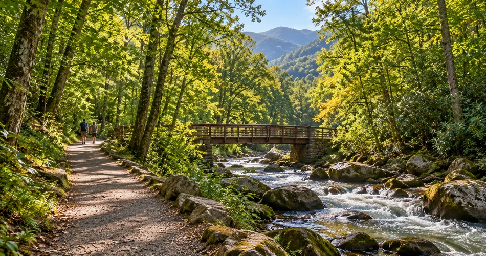
The 5.5-mile Roaring Fork Motor Nature Trail sounds short enough to squeeze between other activities, but that is the wrong way to use it. The one-way road is narrow, winding, and designed for slow travel through forest, streams, historic homesteads, and trail access points. Pull-offs and historic structures make the drive take far longer than the mileage suggests when travelers actually stop instead of treating it as a shortcut.
Before entering the motor trail, the Noah “Bud” Ogle farmstead gives context to the families who once lived in this part of the mountains. Farther along, visitors can reach the Trillium Gap trailhead for Grotto Falls, although parking there is limited. Near the end of the road, Place of a Thousand Drips spills down a roadside rock face and is especially noticeable after rain.
A few practical details matter:
- The road is one way and seasonal.
- Buses, trailers, and motor homes are prohibited.
- Parking tags cannot be purchased along the motor trail.
- In 2026, its scheduled season runs April 17 through November 29, weather and maintenance permitting.

Drive Toward Newfound Gap Without Treating Every Pull-Off as a Task
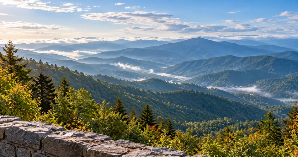
Newfound Gap Road is one of those scenic drives Gatlinburg visitors can enjoy without building an elaborate itinerary around it. The road climbs from lower-elevation forest toward the high country, and the changing vegetation becomes part of the experience. The National Park Service has long described the elevation transition as comparable to traveling from Georgia toward Maine in terms of forest communities, except the change happens vertically rather than across hundreds of miles.
Newfound Gap itself sits at 5,046 feet on the Tennessee–North Carolina boundary. Temperatures there can be considerably cooler than in Gatlinburg, and rain in the lower elevations can become snow at the gap during colder weather. Layers therefore belong in the vehicle even on days when downtown feels mild.
The strongest approach is to stop only where the view genuinely looks worth stopping for. Travelers do not need to collect every overlook. They can let traffic, cloud cover, and available parking make the decision. The National Park Service specifically advises having alternative destinations in mind because popular parking areas sometimes exceed capacity.
Go Up to Kuwohi When the Weather Gives a Reason
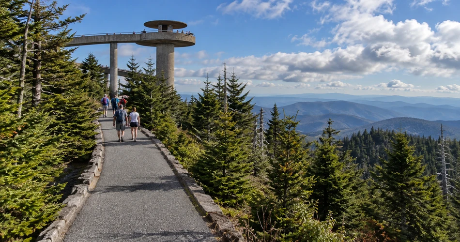
Kuwohi is worth saving for the kind of day when the high country is actually visible. Formerly widely known as Clingmans Dome, Kuwohi reaches 6,643 feet and is the highest point in Tennessee as well as the highest point in Great Smoky Mountains National Park. From the parking area, visitors reach the observation tower by a paved half-mile climb. The path is short but steep, and the full outing is a one-mile round trip.
At the top, the distinctive tower provides 360-degree views when weather cooperates. The important phrase is when weather cooperates. Clouds, precipitation, and cold temperatures are common at this elevation, and conditions may be 10 to 20°F cooler than the surrounding lowlands. A flexible traveler has an advantage here: if the mountain is buried in cloud, Kuwohi can simply move to another day.
Kuwohi Road is seasonal. For 2026 it is scheduled to remain open through November 29, subject to snow, ice, temporary closures, and other hazards.
Spend an Afternoon in the Arts and Crafts Community Instead of Filling It with Attractions
Some of the most useful extra hours in Gatlinburg are spent away from both the national park and the busiest stretch of the Parkway. The Great Smoky Arts & Crafts Community follows an eight-mile loop around the Glades and Buckhorn Road area and includes more than 100 artists, craftspeople, studios, shops, and galleries. The community traces its roots to 1937, when local artisans began moving their work into the Glades area.
This stop works best when treated as a neighborhood rather than a shopping assignment. Pottery, woodwork, paintings, weaving, leatherwork, jewelry, and traditional craft forms appear throughout the route, and some studios allow visitors to see artisans working. That makes the experience more interesting when there is time to linger and ask questions instead of rushing through several stores.
Travelers should check individual studio hours rather than assuming every workshop follows the same schedule. The area's dedicated trolley service can also reduce driving during parts of the year; operating schedules vary seasonally.

Walk Downtown Slowly Instead of Trying to “Do” Downtown
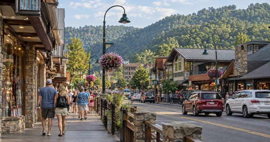
Downtown Gatlinburg can look like a place that demands constant activity, but it becomes easier to appreciate when a traveler stops turning every storefront into a decision. The Parkway is compact enough for long stretches to be handled on foot, while River Road and the quieter riverside paths offer short breaks from the heaviest pedestrian flow. Gatlinburg's tourism information specifically points visitors toward the river walk for a calmer stroll beside the Little Pigeon River.
A useful rhythm is to walk one section, stop for something simple, then continue only when the mood calls for it. Window-shopping, watching the river, sitting for a while, or crossing to a side street can fill an hour without producing the feeling that another Gatlinburg attraction has been “completed.”
The free Gatlinburg Trolley is also helpful when the walk has gone farther than expected. The city operates multiple routes and provides real-time location information; summer service generally runs longer than winter service, so current hours should be checked before relying on a late return.
Pick One Mountaintop Attraction and Give It Enough Time
When a traveler has extra time, the better choice is often one substantial paid attraction rather than several rushed ones. Gatlinburg SkyPark and Anakeesta offer different versions of a mountaintop afternoon, and either can comfortably occupy several hours.
SkyPark's best-known feature is the SkyBridge, a pedestrian suspension bridge stretching nearly 700 feet across the mountain. It is reached from downtown by the SkyLift and works well for visitors primarily interested in elevated views and walking rather than filling an entire day with rides.
Anakeesta is broader in scope. Its current mountaintop area covers more than 90 acres and includes the Crystal Express gondola, Vista Gardens, AnaVista Tower, play areas, coasters, and an expanded Treetop Skywalk. The Crystal Express opened as part of Anakeesta's 2026 expansion and uses enclosed glass cabins for the roughly 600-foot climb from downtown.
Whichever is chosen, the extra time is better spent staying for changing light than racing back down after the first viewpoint.

Keep a Weather Plan and a Parking Plan Instead of a Packed Schedule
A flexible Gatlinburg itinerary still benefits from preparation. The difference is that the preparation should create options rather than appointments. Great Smoky Mountains National Park requires a parking tag whenever a vehicle is parked inside park boundaries for more than 15 minutes. Current prices are $5 daily, $15 weekly, and $40 annually, and the physical tag must be displayed in the vehicle. Buying one does not reserve a parking space.
Weather also matters more here than many first-time visitors expect. Conditions can differ sharply between downtown Gatlinburg, Newfound Gap, and Kuwohi because of the elevation change. Primary roads such as Newfound Gap Road remain open year-round, weather permitting, while roads including Roaring Fork Motor Nature Trail and Kuwohi Road close seasonally.
A traveler with unscheduled time can use that uncertainty rather than fight it. Clear morning? Go high. Rain overnight? Roaring Fork's streams may be more dramatic. Cloudy mountain day? Spend the afternoon around crafts or downtown. That is a more resilient plan than forcing every stop onto one fixed timetable.
Leave One Part of the Day Open on Purpose
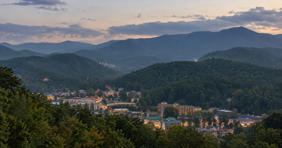
The most useful lesson for travelers deciding what to do in Gatlinburg is that spare time is not a scheduling problem. It is often what allows the place to feel less like an attraction corridor and more like a mountain town beside a national park. An hour left open may become a river walk. A cloudy summit plan may turn into a pottery studio visit. A drive toward Newfound Gap may stop early because the light at one overlook is better than expected.
That is also where returning travelers gain something that first visits sometimes miss. Great Smoky Mountains scenery changes with weather, season, water level, foliage, and light, so repeating a road or trail does not necessarily repeat the experience. Downtown also feels different early in the morning, during a late-afternoon lull, and after the surrounding ridges have gone dark.
The strongest Gatlinburg days usually leave enough room for a decision made on location. A traveler can plan the practical things—parking tag, current closures, footwear, layers, transportation—then allow the actual day to determine the order. That approach turns extra time into the best part of the trip rather than something that needs to be filled.
Next post A Day Around Gatlinburg With No Need to Rush Back
Previous Post Where to Spend a Quiet Morning Around Gatlinburg
About Author
