English


 Home
 Hotels
 Car Rental
 Rewards
 Travel Guide

The Parts of Gatlinburg That Are Easy to Overlook

A first trip to Gatlinburg tends to happen at eye level. Visitors see the Parkway, attraction entrances, restaurant signs, chairlifts, and the steady procession of people moving between them. That version of town is impossible to miss. What is easier to overlook are the places just beyond the obvious route: a river running behind downtown, a dirt trail that quietly crosses into the national park, a city park beside a mountain creek, old farm buildings above town, and an entire neighborhood where pottery wheels and carving tools matter more than bright signs.
Those places are not necessarily secret. Most are clearly marked, publicly accessible, and sometimes only minutes from the busiest blocks. They become Gatlinburg hidden gems because visitors often have a limited number of days and naturally aim first for the attractions they have already heard about.
A better approach is to leave a few hours without tickets attached to them. River Road Gatlinburg, the Gatlinburg Trail, the Arts and Crafts Community, and the nearby edges of Great Smoky Mountains National Park show how quickly the atmosphere can change. A traveler can go from heavy foot traffic to a creek, forest path, historic cabin, or working craft studio without turning the day into a major road trip.
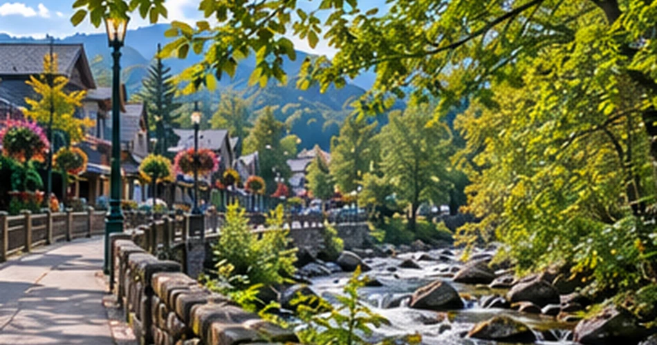
River Road Is the Turn Many Visitors Walk Past
It takes surprisingly little effort to change the sound of downtown Gatlinburg. One turn away from the busiest blocks can replace traffic and storefront noise with the Little Pigeon River moving over rocks. Gatlinburg’s official visitor information recommends the river walk as the quieter alternative to the Parkway and notes gazebos and benches along the route.
That makes River Road Gatlinburg particularly useful when travelers are not trying to “do” anything. It works for a twenty-minute walk after breakfast, an easy reset between attractions, or a longer wander before dinner. Town remains close; this is not a wilderness trail pretending downtown no longer exists. The pleasure comes from having both environments in the same walk.
Morning and late afternoon tend to suit the river especially well. Softer light reaches beneath the trees, rocks are easier to photograph without hard glare, and the benches feel like places to actually sit rather than quick stops between reservations.
Visitors should resist the urge to hurry through because the route looks simple on a map. A short pause beside the water often becomes one of those small trip memories that lasts longer than another photo taken in a crowded queue.
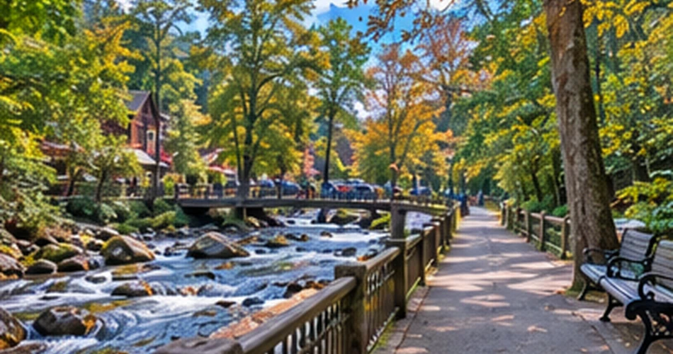
The Gatlinburg Trail Quietly Connects Town and the Smokies
The Gatlinburg Trail is easy to underestimate because it begins so close to town. Rather than requiring a scenic drive before the walking begins, it links River Road with Sugarlands Visitor Center and gradually trades streets for cove hardwood forest.
The National Park Service lists the route at approximately four miles roundtrip. Parts near Sugarlands include roadside and paved sections before the route becomes a broad dirt trail, and historic stone chimneys appear along the way. Although much of the trail is relatively wide and gentle, it is not an ADA-accessible paved promenade; visitors can still encounter roots, uneven dirt, crushed stone, and a few steeper sections.
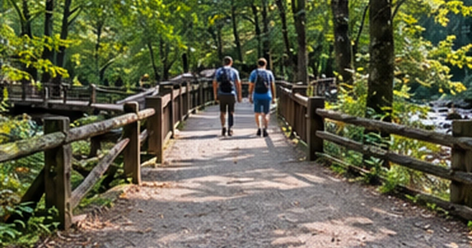
There is no requirement to complete the full distance. Someone looking for Gatlinburg hidden gems can walk only as far as the bridge or follow the river for half an hour before turning around.
Another unusual detail makes the trail useful for some families: the Gatlinburg Trail and Oconaluftee River Trail are the only two park trails where pets are permitted, provided they are leashed, and bicycles are allowed here as well.
The trail works best when it is treated as a transition rather than an athletic objective. The interesting part is realizing how quickly Gatlinburg gives way to Great Smoky Mountains National Park.
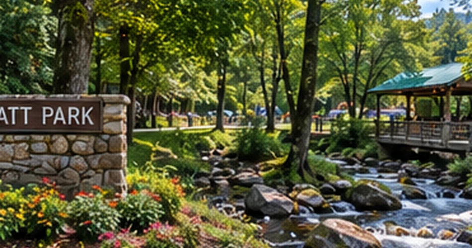
Mynatt Park Feels More Like Everyday Gatlinburg
Travel guides naturally concentrate on the Parkway and the national park, which leaves Gatlinburg’s ordinary city spaces surprisingly easy to miss. Mynatt Park is a good example. Located on Asbury Lane near LeConte Creek, it is one of three public parks maintained by the City of Gatlinburg.
The park is not trying to compete with a waterfall or mountaintop attraction. Its appeal is precisely that it feels functional: paths, recreation courts, picnic facilities, trees, creek access, and places to sit. Recent accessibility improvements added concrete linear paths through the park and improved access to LeConte Creek, along with updates to restrooms, the pavilion, basketball areas, and pickleball courts.
That makes it a useful stop for travelers with children, anyone needing a quiet lunch outdoors, or visitors who have had enough ticketed attractions for one afternoon. It also shows a more everyday side of town—the Gatlinburg used by residents rather than only the version designed around vacation schedules.
A traveler should not go expecting a headline attraction. Instead, Mynatt Park works as an hour without pressure. Bring food, walk by the creek, sit under the trees, and let the itinerary become less ambitious for a while. Sometimes the overlooked place is useful precisely because almost nothing is demanding attention.
The Arts and Crafts Community Deserves More Than a Souvenir Stop
The Arts and Crafts Community is hardly unknown, but it is frequently treated too quickly. Visitors drive the loop, buy one keepsake, and return downtown without spending enough time inside the studios where the interesting part actually happens.
The community traces its modern roots to 1937, when local artisans began moving their workshops from downtown to home studios in the Glades. Today, studios, galleries, shops, and eateries are spread along an eight-mile loop, with pottery, painting, woodcraft, leatherwork, basketry, quilts, jewelry, and other handmade work represented.
What makes this one of the more rewarding Gatlinburg hidden gems is not simply the shopping. It is the chance to see how things are made. A potter centering clay, a woodworker shaping a bowl, or an artist discussing a finished piece gives context that a standard souvenir counter cannot provide.
The right pace is selective. Rather than trying to visit every studio, a traveler can choose three or four based on genuine interest and give each one some time. The loop is large enough that wandering without a plan can easily consume half a day.
For returning visitors, this area often produces a completely different Gatlinburg experience. It replaces the Parkway’s concentration of attractions with individual workshops and conversations, and it rewards curiosity more than speed.

Some of the Best Park Stops Sit Before the Famous Viewpoints
Visitors entering Great Smoky Mountains National Park from Gatlinburg often have a famous destination already fixed in mind. They may be headed toward Newfound Gap, Kuwohi, Rainbow Falls, or another well-known trail. That focus makes the smaller sites close to town easy to drive straight past.
This part of the park rewards a different strategy. A traveler can spend a meaningful couple of hours near Gatlinburg without climbing thousands of feet or committing to a long waterfall hike. The Noah “Bud” Ogle farmstead and Sugarlands Valley Nature Trail offer two very different versions of that slower approach: one centered on mountain settlement history, the other on an easy paved forest walk.
They also fit well into uncertain days. If cloud cover makes a high viewpoint pointless or afternoon weather changes plans, these lower-elevation places can still give visitors forest, streams, historic features, and a clear sense of being inside the Smokies.
A few practical Gatlinburg travel tips help here:
- Check current park road and trail conditions before leaving town.
- Do not assume a short trail means unlimited parking.
- Vehicles parked in the Smokies for more than 15 minutes require a parking tag.
- Leave room to change plans when weather or parking makes another stop more sensible.
Noah “Bud” Ogle Place Is Easy to Pass on the Way Somewhere Else
Cherokee Orchard Road is often treated as the approach to somewhere else, especially by visitors heading toward Roaring Fork or the Rainbow Falls trailhead. That makes Noah “Bud” Ogle Place particularly easy to miss.
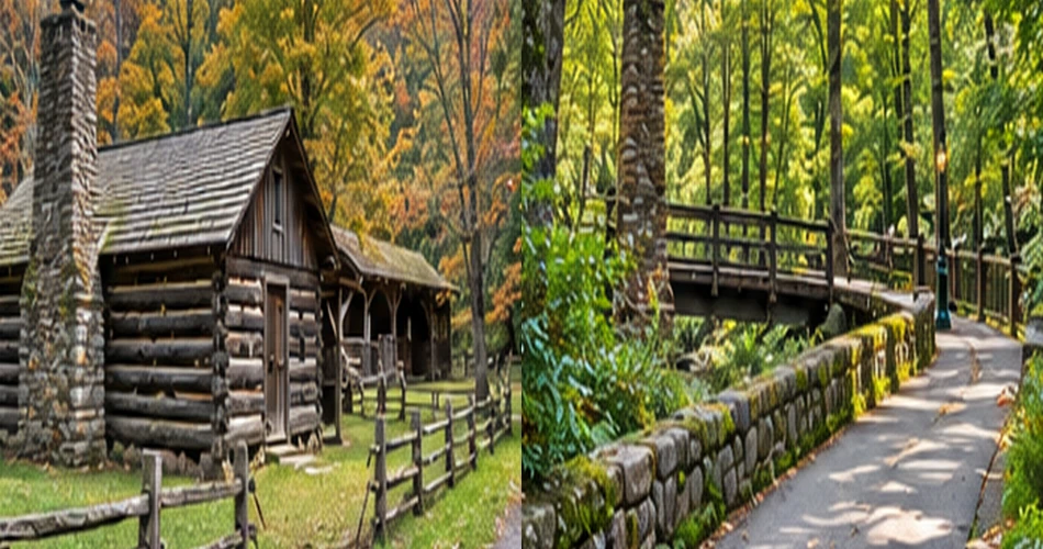
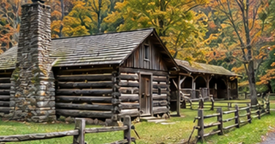
The preserved farmstead sits just before the Roaring Fork Motor Nature Trail and provides a compact look at the mountain settlement landscape that existed before tourism became Gatlinburg’s defining industry. The site includes the historic cabin, while the roughly 0.7- to 0.8-mile Ogle Place loop reaches additional farm structures, including a barn and tub mill.
The cabin itself is notable for its saddlebag form, with two sections and prominent porches. More important than the architectural terminology, though, is the setting. The surrounding terrain is wooded, rocky, and noticeably less forgiving than a postcard meadow. That makes the farmstead easier to understand as a working mountain home rather than decorative “old-time” scenery.
A visitor can walk the loop slowly without turning the stop into a major hike. Roots, uneven ground, and short steeper sections mean proper shoes still help.
This is one of those places where ten extra minutes changes the day. Instead of driving directly toward the next attraction, the visitor gets a tangible piece of Gatlinburg’s earlier story.
Sugarlands Valley Nature Trail Is Short Enough to Be Underrated
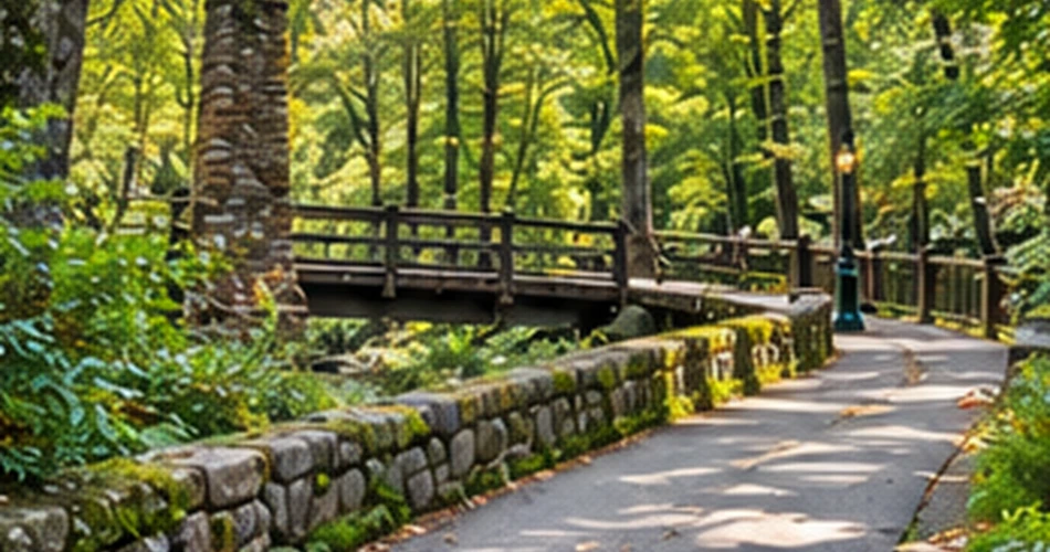
Long hikes naturally dominate Smokies conversations, which can make a half-mile paved loop sound too minor to bother with. Sugarlands Valley Nature Trail proves otherwise. The National Park Service describes it as a 0.5-mile paved loop through cove hardwood forest, with streamside views, rock walls, and historic stone chimneys along the route.
The trail is also ADA accessible and flat, making it one of the more broadly usable outdoor experiences close to Gatlinburg.
Its strength is detail rather than scale. Visitors are close enough to notice moss on stonework, changes in tree bark, moving water between rocks, and remnants of earlier human occupation. Someone racing toward a mountaintop overlook may consider those small things; someone walking slowly often finds they are the entire point.
It is especially useful for mixed-ability groups, older travelers, families with limited walking time, or anyone who wants forest without a strenuous climb. Because the walk is short, it can also fit before breakfast, between longer activities, or near the end of a day when nobody wants another major commitment.
That flexibility is exactly why it belongs on a list of overlooked Gatlinburg places. Not every memorable Smokies outing needs a dramatic mileage number attached to it.
Greenbrier Is Worth Remembering When the Main Routes Feel Full
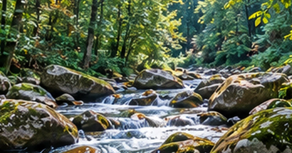
Greenbrier lies roughly twenty minutes east of Gatlinburg in the northeastern part of the national park, yet it can feel far removed from both downtown and the busiest Smokies corridors. The entrance road follows the Middle Fork of the Little River upstream toward a riverside picnic area and several trailheads.
The area is known for wildflowers, waterfalls, fishable streams, historic structures, and cemeteries, but visitors do not need to assemble a full hiking itinerary to appreciate it. Sometimes the best use of Greenbrier is simply a slow drive followed by time beside the river.
Its scale also suits travelers who have already spent a day dealing with crowded parking and high-profile viewpoints. Water, hardwood forest, picnic space, and trail access are all here without the feeling that every stop must produce a famous photograph.
Greenbrier should not be advertised as guaranteed solitude. This is still part of one of America’s most heavily visited national parks. But compared with a schedule built entirely around the same marquee destinations, it gives travelers another direction to go when the day needs a reset.
For first-time visitors, Greenbrier may be saved for a second or third day. Returning travelers may find it becomes one of the reasons to keep coming back. It shows how much of Gatlinburg’s appeal lies not in any single attraction but in how many different landscapes begin close to town.
The Gatlinburg Worth Noticing Is Often Just Off the Main Route
The overlooked parts of Gatlinburg are not hidden behind secret gates. Most require something simpler: turning one block away from the Parkway, walking another half mile, or resisting the urge to drive straight past a small brown park sign because a more famous destination is waiting farther ahead.
That is what connects River Road, Mynatt Park, the Gatlinburg Trail, the Arts and Crafts Community, Noah “Bud” Ogle Place, Sugarlands Valley, and Greenbrier. None asks travelers to abandon the Gatlinburg they came to see. They simply add another layer to it.
First-time visitors can fit one or two of these stops around the big attractions. Returning travelers may want to reverse the priorities and build a day around the quieter places instead.
The most useful lesson is not that crowded attractions should be avoided. The Parkway is part of Gatlinburg’s character, and famous Smokies viewpoints are famous for good reasons. But a trip made entirely from highlights can begin to feel strangely similar from hour to hour.
Leaving space for small places changes that. A creekside bench, an old chimney, an artisan at work, or a forest path leading away from town gives the trip texture. Those are often the parts people almost skipped—and the ones they end up talking about later.
Next post What to Do When You Have an Extra Day in Gatlinburg
Previous Post A Morning in Gatlinburg Before the Town Gets Busy
About Author