 English

 Home
Home Hotels
  Car Rental
 Rewards
 Travel Guide
Where to Drive From Gatlinburg for Better Mountain Views

Gatlinburg already has an impressive mountain backdrop, but downtown buildings, trees, traffic, and steep valley walls can keep the horizon surprisingly close. Anyone who wants long ridgelines and those layered blue-gray Smoky Mountain views should plan to spend at least part of the trip behind the wheel.
The good news is that some of the best Gatlinburg scenic drives begin only minutes from town. One road climbs thousands of feet toward the Tennessee–North Carolina state line. Another reaches the highest road-accessible area in Great Smoky Mountains National Park. Farther west, a parkway follows the foothills with overlooks positioned specifically for wide mountain views. Cades Cove takes the opposite approach, dropping visitors into an open valley with peaks rising around it.
Drivers should not judge these routes by mileage alone. Roads in Great Smoky Mountains National Park are slow and winding, and the National Park Service notes that average travel speed on many paved park roads is about 35 mph. Scenic stops, wildlife, weather, and traffic can stretch a short-looking drive into most of an afternoon. That is not a flaw. Around Gatlinburg, getting there is very much part of the plan.
Drive Newfound Gap Road for the Classic High-Elevation Smokies
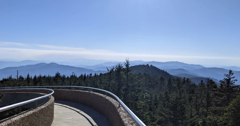
For a first scenic drive from Gatlinburg, Newfound Gap Road is difficult to beat. Officially part of U.S. 441, the road crosses Great Smoky Mountains National Park between Gatlinburg and Cherokee, North Carolina, climbing steadily from lower hardwood forest toward the high country. Instead of presenting one grand viewpoint and calling it a day, the route changes character as it gains elevation.
The early miles follow wooded mountain slopes where streams and dense forest dominate the scenery. Higher up, openings begin to reveal distant ridges, particularly when cool air, rain, or passing clouds create the smoky haze associated with the mountains. Eventually, drivers reach Newfound Gap at the Tennessee–North Carolina state line, one of the most useful roadside stops for broad mountain scenery.
Newfound Gap Road is one of the park's primary roads and is generally open year-round, weather permitting. Snow, ice, falling trees, or other hazardous conditions can still cause temporary closures, particularly at higher elevations.
A few practical habits make this Great Smoky Mountains road trip much more enjoyable:
- Leave Gatlinburg early when possible, especially during fall foliage season and summer weekends.
- Use designated pullouts instead of stopping along narrow road shoulders.
- Expect noticeably cooler conditions near Newfound Gap than in downtown Gatlinburg.
- Check current road conditions before leaving when winter weather or strong storms are possible.
This is the drive for travelers who want to watch the Smokies change one elevation zone at a time rather than simply arriving at a viewpoint.
Continue From Newfound Gap to Kuwohi for the Highest Views
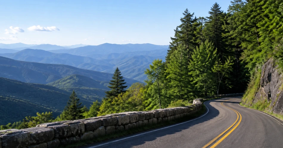
Drivers who reach Newfound Gap when Kuwohi Road is open should seriously consider continuing uphill. Kuwohi, formerly known as Clingmans Dome, rises to 6,643 feet and is the highest point in Great Smoky Mountains National Park. The short mountain road leading toward it packs an unusual amount of scenery into a relatively small distance.
Kuwohi Road branches from Newfound Gap Road and runs about seven miles toward the visitor area near the summit. The landscape becomes noticeably different as elevation increases. Dense high-elevation spruce-fir forest replaces much of the lower hardwood scenery, while roadside openings reveal mountains extending far beyond the immediate ridges. The air can feel dramatically cooler too, which catches plenty of summer visitors dressed for Gatlinburg rather than a mountaintop.
The road is seasonal rather than year-round. For the 2026 season, the National Park Service lists Kuwohi Road as scheduled from April 1 through November 29, subject to temporary closures caused by snow, ice, and hazardous weather. Parking demand at Kuwohi can exceed capacity during busy periods.
Make Time for the Kuwohi Observation Tower
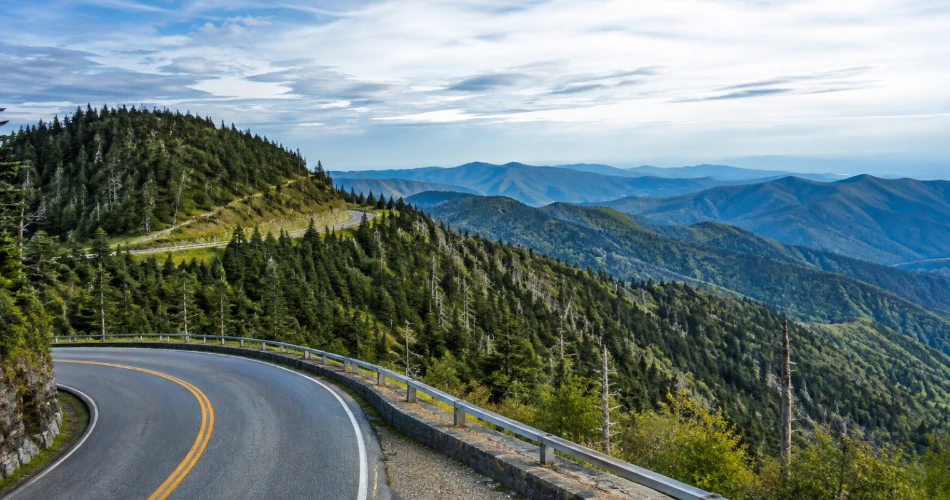
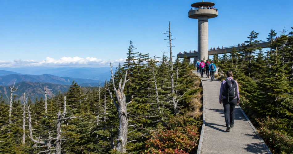
The road itself provides rewarding Smoky Mountain views, but drivers willing to leave the car can continue to the observation tower near the summit. Reaching it requires a paved half-mile trail from the parking area. The distance sounds modest; the steady uphill grade has a way of making half a mile feel considerably more ambitious.
From the tower area, visitors gain a much broader perspective on the high Smokies than they get from the streets of Gatlinburg. On clear days, ridges appear in layers across the horizon, while shifting clouds can produce an entirely different scene within minutes. The Appalachian Trail also passes through this high-elevation area.
Clear visibility is never guaranteed in the Smokies, so travelers should resist building the entire day around one perfectly clear photograph. Clouds rolling across the ridges are part of the landscape here, and sometimes they create a more interesting view than flawless blue sky.
Parking is another reason to arrive early. The National Park Service specifically warns that capacity at popular destinations such as Kuwohi can be exceeded. Anyone stopping for more than 15 minutes within Great Smoky Mountains National Park also needs to follow the park's parking-tag requirements.
Take Foothills Parkway Toward Wears Valley for Wide-Open Views
Newfound Gap puts drivers inside the high mountains. Foothills Parkway offers almost the opposite experience: it steps back from the main Smokies and gives visitors room to see the range as a complete landscape.
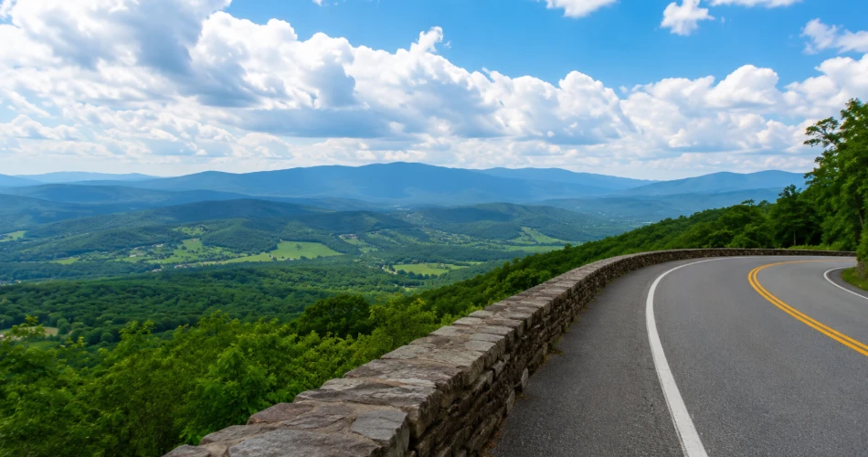
The Walland-to-Wears Valley section is one of the best mountain drives from Gatlinburg for travelers who care more about broad panoramas than reaching a famous summit. The approximately 14.75-mile section climbs to nearly 2,500 feet near Caylor Gap and passes several overlooks facing Great Smoky Mountains National Park and Wears Valley. The road includes sweeping curves and viaducts across the slopes of Grassy Mountain, Rocky Mountain, and Davis Mountain.
The appeal is simple: the foreground falls away. Instead of looking upward through a narrow valley, drivers can look across open country toward layered ridges, including recognizable high peaks on clear days.
This section was completed in 2018, so it also feels different from many older park roads. The pavement is broad and smooth, while well-spaced overlooks make it easier to stop without turning every photograph into a parking challenge.
Sunrise and late afternoon are particularly rewarding because lower-angle light gives the folds of the mountains more definition. Drivers should still give themselves time. Foothills Parkway is not the road for chasing a dinner reservation with eight minutes to spare. A good overlook has a habit of turning a two-minute stop into twenty.
Keep Going Toward Walland and Chilhowee for a Longer Ridge Drive
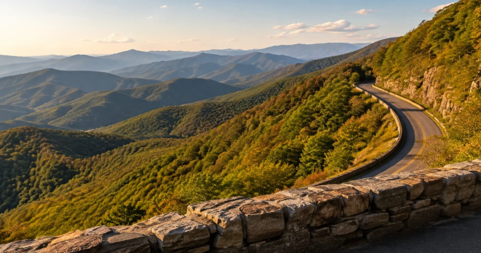
Travelers with more time can extend the Foothills Parkway experience beyond the Wears Valley section. The Chilhowee-to-Walland portion runs 16.6 miles one way and includes numerous places to stop. According to the National Park Service, this section has 16 parking areas, with 14 serving as scenic overlooks.
The changing direction of those overlooks is part of the fun. Some face east toward Great Smoky Mountains National Park and the mountains surrounding Cades Cove, while others look west toward the lower Tennessee landscape around Maryville and Alcoa. That contrast gives travelers a better understanding of just how abruptly the Smokies rise from the foothills.
Look Rock is one of the notable stops along this section. The area includes a picnic area and access to the Look Rock Tower Trail, a paved 0.8-mile route. Even visitors who skip the trail still get a scenic drive with considerably more stopping opportunities than many mountain roads provide.
The western Foothills Parkway works especially well when a trip has already included Newfound Gap Road. Instead of repeating another steep forest climb, drivers get a ridge-road perspective with longer sightlines.
For photographers, the frequent pullouts are particularly useful. Rather than trying to shoot through a windshield while a passenger says, “Wait, that was the view,” the route actually provides safe places to stop and look.
Drive Little River Road Toward Cades Cove for Mountains Around an Open Valley
Not every memorable mountain view requires climbing higher. Cades Cove proves that sometimes the better strategy is to drive into an open valley and let the mountains rise around the road.
From the Gatlinburg area, Little River Road runs west through Great Smoky Mountains National Park toward Townsend and the route leading into Cades Cove. Much of the journey follows the Little River, with forested slopes, stream scenery, and roadside pullouts breaking up the drive. It feels enclosed in places, but that only makes the arrival at Cades Cove more dramatic.
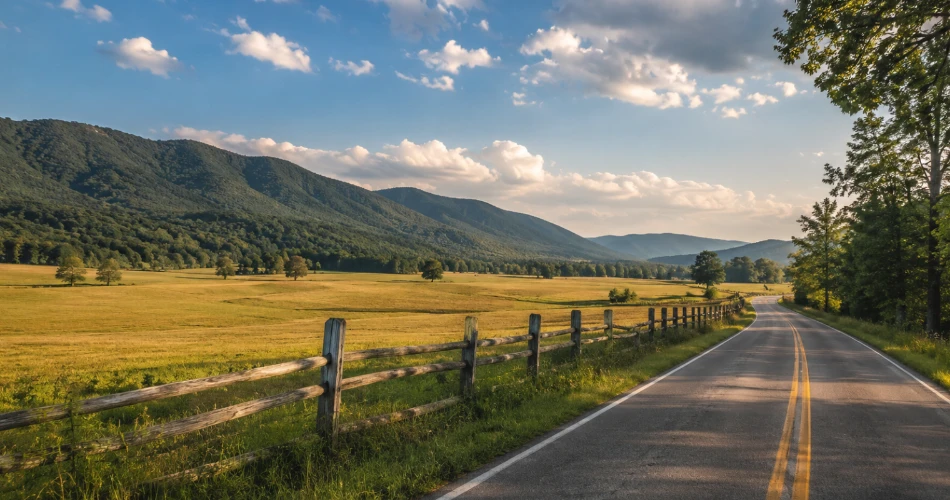
Cades Cove is a broad mountain valley surrounded by Smoky Mountain ridges. The 11-mile one-way loop road travels through open fields, woodland, and areas containing historic buildings. Deer and other wildlife are commonly associated with the valley, though sightings should never be treated as guaranteed.
Cades Cove Loop Road is generally open year-round, weather permitting, but its operating pattern needs to be checked before making the drive. In 2026, the National Park Service states that the loop is closed to motor vehicles on Wednesdays, typically from May through September, allowing bicycle and pedestrian use instead.
Slow Down Once the Road Reaches Cades Cove
Anyone driving to Cades Cove strictly to complete the loop as quickly as possible has misunderstood the assignment. This is a place where the view often gets better after the engine is switched off.
Pullouts and parking areas allow visitors to look back across fields toward surrounding mountain walls. Early morning can bring low mist over the valley, while later light tends to reveal more texture along the ridges. Historic churches, cabins, barns, and other structures add another layer to the scenery, reminding visitors that Cades Cove was a settled mountain community long before the national park was established.
Traffic can move very slowly when wildlife appears near the roadway, particularly during busy seasons. Drivers should stay in their vehicles when appropriate, never approach or feed animals, and avoid stopping in the travel lane simply because someone has spotted a deer.
The route is best treated as a half-day outing rather than a quick detour. Little River Road, roadside stops, the Cades Cove Loop, and the return journey together can occupy several hours even without a long hike.
That slower pace is exactly what makes it different from the high-elevation routes. Newfound Gap delivers distant horizons; Cades Cove places the traveler inside the mountain landscape.
Head East Toward Cosby for a Quieter Foothills Parkway Drive
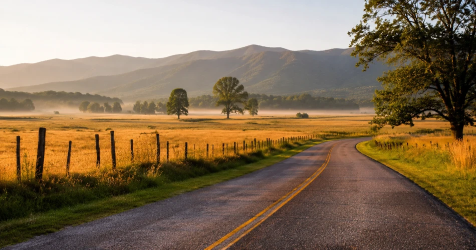
Travelers who have already driven west from Gatlinburg should consider pointing the car in the opposite direction. Foothills Parkway East near Cosby is much shorter than the western sections, but it offers a useful combination of big views and lighter sightseeing traffic.
The completed section runs about 5.6 miles between Cosby Highway and Interstate 40. It climbs roughly 1,000 feet along Green Mountain and includes four principal scenic overlooks. From these stops, visitors can look toward Cosby Valley, Cherokee National Forest, Raines Knob, and the eastern Appalachian landscape.
Because the road is short, it works particularly well for travelers who want scenic drives near Gatlinburg without committing most of the day. Green Mountain Overlook faces southeast and is especially well positioned for morning light, while other overlooks face northwest and provide a different perspective on the surrounding terrain.
Cosby also feels noticeably removed from the commercial energy of central Gatlinburg. The forest and foothill setting takes over quickly, so the trip feels like an actual change of scenery rather than another lap around town.
This route is a good reminder that “better mountain views” do not necessarily mean “highest elevation.” Sometimes the quieter overlook where there is time to stand still for ten minutes beats the famous summit reached alongside several hundred new friends.
Choose the Drive Around Weather, Light, and the Kind of View Wanted
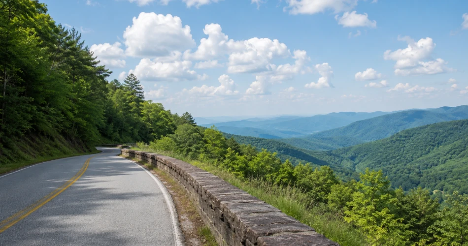
There is no single best route because these Gatlinburg scenic drives show completely different versions of the Smokies. Newfound Gap Road works best when travelers want changing elevation, high passes, and dramatic forest transitions. Kuwohi raises the experience into the park's highest country. Foothills Parkway provides the long-distance ridge views that downtown Gatlinburg cannot easily offer, while Cades Cove trades elevation for an open valley framed by mountains.
Weather may ultimately make the decision. Conditions change rapidly with elevation, and high roads can be cloudy, icy, or temporarily closed even when Gatlinburg itself looks perfectly comfortable. Primary park roads such as Newfound Gap Road, Little River Road, and Cades Cove Loop Road are normally open throughout the year, weather permitting, while secondary roads such as Kuwohi Road operate seasonally.
Drivers should also remember the park's parking rules. A parking tag is required when parking inside Great Smoky Mountains National Park for more than 15 minutes.
For the simplest decision, travelers can match the road to the experience: Newfound Gap and Kuwohi for altitude, Foothills Parkway for panoramas, Cades Cove for valley scenery, and Cosby for quieter roadside viewpoints.
The mountains are already visible from Gatlinburg. These roads simply give them enough distance, height, and open space to look as large as they really are.
Next post A Scenic Day Trip From Gatlinburg Without Going Too Far
Previous Post Small Mountain Towns Worth Visiting Near Gatlinburg
About Author
