 English

 Home
Home Hotels
  Car Rental
 Rewards
 Travel Guide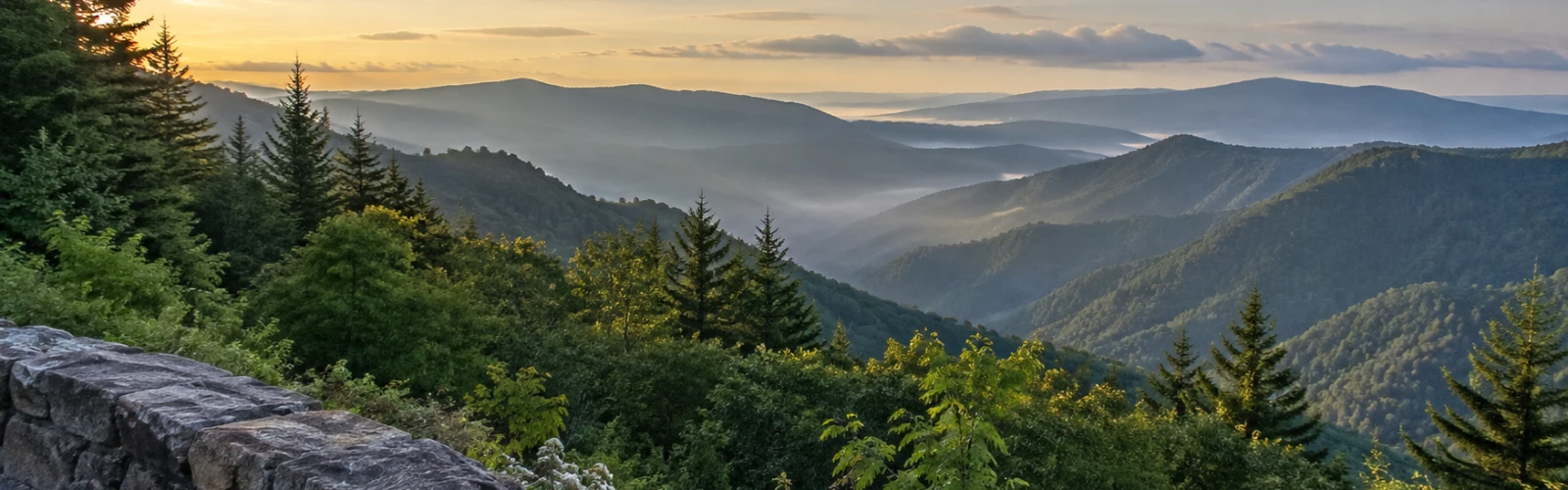
The Mountain Stops Around Gatlinburg That Deserve More Time

A drive out of Gatlinburg can become rushed surprisingly quickly. Newfound Gap is marked on the map, Kuwohi is farther up the mountain, a waterfall trail is tempting, and before long the day turns into a sequence of parking lots and photographs. The Smokies rarely reward that kind of schedule as much as travelers expect.
Many of the best Gatlinburg mountain stops are interesting precisely because there is more happening than the first view suggests. A high overlook changes when clouds begin moving through the valley. A picnic area becomes more than a lunch stop when a short trail disappears into a cove hardwood forest. A narrow road outside downtown Gatlinburg starts revealing old homesites, streams, waterfalls, and traces of communities that existed long before the national park.
The better approach is not necessarily to hike farther. It is to leave enough room in the day for a place to unfold naturally.
That can mean spending an extra half hour beside the river at Chimneys, walking beyond the building at Sugarlands, waiting for visibility to improve at Newfound Gap, or treating Roaring Fork as an afternoon rather than another scenic road to finish.
These are the Great Smoky Mountains scenic stops where staying longer usually gives back more than adding another destination.
Sugarlands Is Worth Walking Beyond the Visitor Center
Sugarlands is often the practical beginning of a Smokies day. The visitor center sits about two miles south of Gatlinburg on Newfound Gap Road and provides park information, exhibits, maps, restrooms, and access to several nearby walks. That makes it easy to stop for ten minutes, collect what is needed, and immediately continue toward the mountains.
The better version of the stop begins after leaving the building.
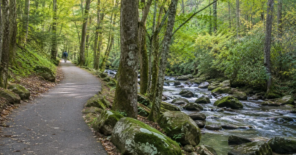
The paved Sugarlands Valley Nature Trail makes a half-mile loop through forest beside the West Prong area and is one of the park's accessible trails. It is short enough to fit naturally into the beginning of a driving day rather than feeling like a separate hiking commitment.
Cataract Falls is another easy reason not to leave immediately. The forested route from the visitor-center area is about 0.7 mile round trip and leads to a roughly 40-foot waterfall. The waterfall is noticeably more energetic after wet weather, while the walk itself passes creek crossings and mature woodland.
Sugarlands works particularly well early in the day. Instead of beginning the Smokies from behind a windshield, travelers get twenty or thirty quiet minutes in the woods first. It changes the pace before the road begins climbing.
Chimneys Picnic Area Should Not Be Treated Like a Lunch Table
The drive between Sugarlands and Newfound Gap contains plenty of reasons to keep moving uphill, which is exactly why Chimneys Picnic Area is easy to underestimate.
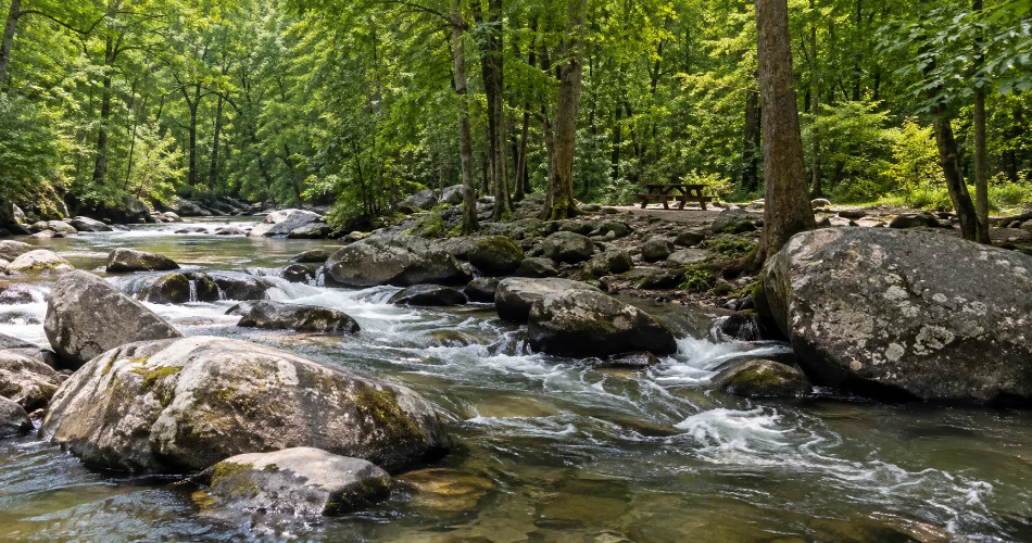
It sits beside mountain water in a shaded cove-hardwood setting and has 68 picnic sites. For the 2026 season, the National Park Service lists Chimneys as operating from April 3 through November 30, weather permitting. Unlike Greenbrier and Metcalf Bottoms, it is not a year-round picnic area.
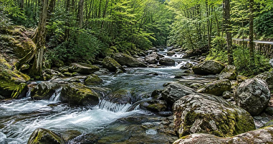
Its appeal is simple. Water moves around large rounded boulders beside the picnic area while dense forest closes in around the road. On a warm day, it feels considerably more like a mountain break than an ordinary roadside picnic.
The nearby Cove Hardwood Nature Trail adds another reason to stay. The loop is roughly three-quarters of a mile and is especially worthwhile during the spring wildflower season.
A good Smokies schedule might give Chimneys an hour rather than twenty minutes: enough time for lunch, a walk through the trees, and a few quiet minutes beside the river before heading toward higher elevations.
That pause matters. By the time the road reaches Newfound Gap and eventually Kuwohi, the day becomes more exposed, cooler, and more focused on long-distance views. Chimneys offers the opposite experience—close forest, rushing water, and shade.
Newfound Gap Changes When Travelers Stay Long Enough to Watch the Weather
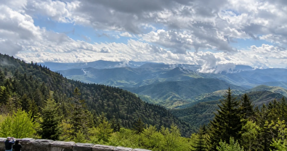
At 5,046 feet, Newfound Gap is the lowest drivable gap through Great Smoky Mountains National Park. Newfound Gap Road crosses the crest here between Tennessee and North Carolina, and conditions can be considerably cooler than they are down in Gatlinburg. Rain in the lower elevations can even arrive as snow at the gap.
Most visitors understandably walk toward the stone overlook first. Ridge after ridge can stretch into the distance when the weather is clear, and it is one of those places where almost everyone reaches for a camera.
The interesting part begins when the first photograph is already taken.
Clouds move quickly through the high country. A ridge that disappears behind gray cloud can return ten minutes later, while sunlight may reach valleys that were completely flat and shadowed when the car arrived. Staying for a while makes the weather part of the view rather than an inconvenience.
The Appalachian Trail also crosses Newfound Gap, adding a completely different dimension to the stop. Visitors do not need to turn the day into a serious hike; even a short walk along the trail offers a sense of how the gap connects to the much larger Appalachian landscape.
A jacket or extra layer is useful even when Gatlinburg feels warm. More importantly, travelers should resist treating Newfound Gap as a photograph taken on the way to somewhere “higher.” It already deserves time of its own.
Kuwohi Is More Rewarding When the Tower Is Not the Only Goal
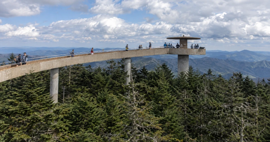
The climb toward Kuwohi feels different before anyone steps out of the car. The forest changes as elevation increases, temperatures fall, and spruce-fir country begins replacing the lower-elevation woods around Gatlinburg.
Kuwohi reaches 6,643 feet, making it the highest point in Great Smoky Mountains National Park and Tennessee. From the parking area, visitors follow a steep paved trail for roughly half a mile to the observation tower, making the walk about one mile round trip. The tower provides 360-degree views when clouds allow them. Temperatures can be 10 to 20 degrees Fahrenheit cooler than in the surrounding lowlands.
That final detail catches plenty of visitors. A warm afternoon in town does not guarantee shirtsleeve weather at the summit.
The trail is short but genuinely steep. Taking the benches along the way as part of the experience rather than racing uphill makes far more sense. The high-elevation forest is worth noticing, especially when cloud moves between the trees.
For 2026, Kuwohi Road is scheduled to remain open through November 29, although snow, ice, and hazardous weather can temporarily close it.
Once at the tower, there is little reason to leave immediately after the first clear photograph. Visibility can improve or disappear within minutes. Kuwohi is one place where waiting is often part of the visit.
Roaring Fork Is a Drive That Works Better at Walking Speed
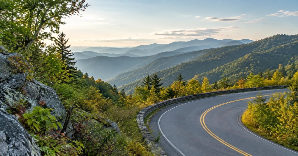
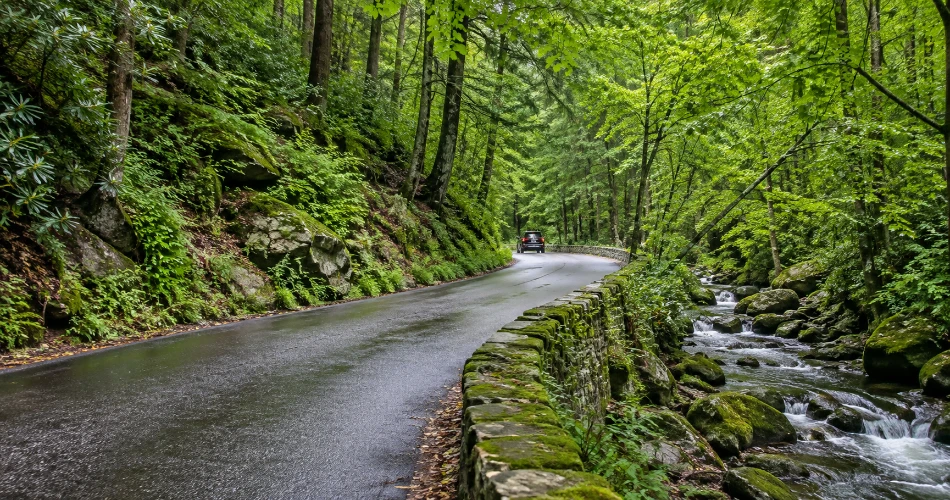
The Roaring Fork Motor Nature Trail begins remarkably close to central Gatlinburg, but the mood changes quickly once the road narrows into the forest.
The one-way route moves through thick woodland where old homesites, historic structures, mountain streams, trailheads, and roadside water features turn the drive into much more than a scenic loop. The National Park Service specifically encourages visitors to allow additional time for historic sites rather than simply driving through.
Parking is one of the practical limits here. Demand frequently exceeds capacity around popular trailheads, and vehicles must remain completely out of the roadway. Parking tags cannot be purchased on the motor nature trail, so they need to be arranged beforehand. Buses, trailers, and motor homes are not permitted.
The road is also seasonal rather than a guaranteed year-round drive.
What makes Roaring Fork good is its small scale. There is no single giant overlook pulling everyone toward the same railing. Instead, the landscape keeps changing: wet rock beside the road, cabins in the woods, rushing water heard through the trees, and trailheads disappearing uphill.
Rushing through removes most of that character.
Noah “Bud” Ogle Place Adds the Human Story to the Forest
Before concentrating only on waterfalls and mountain scenery, travelers should give some time to the historic places around the Roaring Fork area.
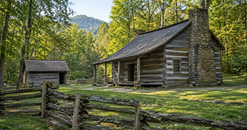
The Noah “Bud” Ogle homestead sits along the approach to the motor nature trail and helps explain how families lived in this mountain landscape before Great Smoky Mountains National Park existed. The remaining structures and surrounding forest make more sense when viewed as parts of a working mountain farm rather than isolated old buildings.
That human history changes how the drive feels afterward.
Streams were not merely scenic features. Woodlands supplied materials and food. Small clearings represented difficult agricultural work rather than open space created for views. Roads and footpaths connected households whose daily lives were shaped by steep terrain and limited transportation.
A slow walk around an old homesite often provides more context than another five minutes at an overlook.
Travelers should also resist the urge to treat historic structures as photography props. The better experience is to walk the site quietly, look at how buildings relate to water and terrain, and imagine how different the valley would have felt without paved roads, parked cars, and downtown Gatlinburg only a short drive away.
Greenbrier Feels Farther From Gatlinburg Than the Drive Suggests
Roughly twenty minutes east of Gatlinburg, Greenbrier trades high overlooks for a heavily forested cove, river scenery, trailheads, wildflowers, historic traces, and quieter stretches of road.
One current National Park Service page describes the partially paved entrance road as following the Middle Fork of the Little River, while other NPS historical material identifies the Greenbrier watershed with the Middle Prong of the Little Pigeon River. Because official park material is inconsistent on the stream naming, the useful travel detail is simpler: the entrance road follows rushing mountain water upstream through a deeply wooded cove toward the picnic area and trailheads.
The Greenbrier Picnic Area is open year-round and has only 12 picnic sites, giving it a much smaller scale than Metcalf Bottoms.
Porters Creek is a natural choice for visitors who want to continue on foot, particularly during the spring wildflower season.
Far more demanding is Ramsey Cascades. The route is eight miles round trip, climbs more than 2,000 feet, and reaches the tallest waterfall in the national park. It should be approached as a serious hike, not something casually added after lunch.
Greenbrier is at its best when the river valley itself is considered the destination. Not every visit needs to end at a waterfall.
Metcalf Bottoms Rewards Anyone Willing to Walk Past the Picnic Area
Metcalf Bottoms is an easy place to underestimate because its first impression is so straightforward: forest, Little River, picnic tables, and a useful break along Little River Road.
The picnic area has 122 sites, making it one of the larger picnic areas in the park. Some sites remain available year-round, while seasonal portions operate on a more limited schedule.
The reason to give Metcalf Bottoms more time lies beyond lunch.
Visitors can follow the Metcalf Bottoms Trail toward Little Greenbrier School. Built in 1881 from tulip poplar logs, the one-room building served as a school, church, and community gathering place. A cemetery beside the school adds another tangible connection to the families who lived in this part of the mountains.
From there, travelers with additional time can continue deeper into the Little Greenbrier area toward the Walker family homesite.
This is one of the stops where the transition is particularly good: a busy riverside picnic area gradually gives way to forest, then to a historic schoolhouse that feels completely separate from the traffic along the road.
It is also a useful reminder that the Great Smoky Mountains are not only a landscape of waterfalls and viewpoints. These valleys held farms, schools, churches, homes, and communities long before visitors began driving through them for scenery.
A Better Smokies Day Usually Has Fewer Stops on It
The easiest mistake around Gatlinburg is thinking that short driving distances mean everything belongs in one itinerary.
Sugarlands, Chimneys, Newfound Gap, and Kuwohi can work naturally together because they follow the same general mountain route. Roaring Fork deserves a separate block of time, particularly if a historic site or waterfall hike is included. Greenbrier can easily fill half a day when the river, picnic area, and trails are allowed to set the pace.
A few practical details make that slower style of travel easier:
- Great Smoky Mountains National Park does not charge a general entrance fee, but a parking tag is required when a vehicle is parked for more than 15 minutes.
- Parking at popular destinations can fill, so an alternative stop is worth having in mind rather than creating unsafe roadside parking.
- Newfound Gap Road is generally open year-round, weather permitting, while roads such as Kuwohi Road and Roaring Fork Motor Nature Trail have seasonal schedules.
- Mountain weather can differ sharply by elevation, especially around Newfound Gap and Kuwohi.
- Current road, trail, and weather conditions should be checked before leaving Gatlinburg, particularly after heavy rain, snow, or storms.
The useful rule is simple: if the day feels like a race between parking areas, something probably needs to come off the list.
The Mountain Stops People Remember Usually Had Time Around Them
A good Smokies day rarely ends with someone wishing they had spent another ten minutes driving.
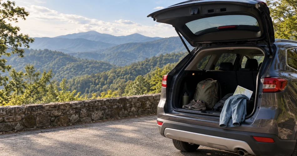
What stays with travelers tends to be smaller: waiting at Newfound Gap until a cloud clears enough to reveal another ridge, hearing water through the trees along Roaring Fork, noticing the temperature change near Kuwohi, or taking a trail at Sugarlands that was never supposed to be part of the schedule.
That is why these Gatlinburg mountain stops deserve more than quick photographs.
The mountains around Gatlinburg make it easy to keep moving because another trail, river, overlook, or historic site is always nearby. But closeness is not the same thing as needing to see everything.
Choosing fewer places makes room for the details that separate one Smokies stop from another: the spruce-fir forest near the highest elevations, the old community landscape around Little Greenbrier, the water running beside Chimneys, and the shaded cove around Greenbrier.
Travelers heading into Great Smoky Mountains National Park do not need an empty itinerary. They simply need some space in it.
That space is what allows a short roadside stop to turn into the part of the mountain day that gets remembered later.
Next post The Places Around Gatlinburg That Are Worth Slowing Down For
Previous Post Where to Go When Downtown Gatlinburg Starts Feeling Too Busy
About Author
