 English

 Home
Home Hotels
  Car Rental
 Rewards
 Travel Guide
The Gatlinburg Stops That Are Worth Getting Out of the Car For

Gatlinburg makes it very easy to spend a day looking through glass. Newfound Gap Road keeps delivering mountain views, Roaring Fork curls beneath heavy forest, and streams appear beside the pavement often enough that staying in the driver's seat can seem perfectly reasonable. But some of the best Gatlinburg stops only make sense after the engine is switched off. A short walk can turn a roadside creek into a waterfall. A historic cabin becomes much more interesting when its barn, mill, and surrounding forest are seen on foot. At high elevation, stepping away from the windshield brings cold air, changing forest, and mountain ridges into the same experience.
That does not mean every pullout deserves half an hour. The trick is knowing which Great Smoky Mountains stops have something meaningful beyond the parking space. The places below include easy walks, longer hikes, historic landscapes, streamside breaks, and mountain viewpoints that give a Gatlinburg driving day some shape rather than turning it into one long sequence of windshields and brake lights.

Sugarlands Visitor Center Is Worth More Than a Restroom Stop
Sugarlands Visitor Center sits only about two miles south of Gatlinburg on Newfound Gap Road, making it one of the easiest places to rush through. That would be a mistake. This is where a park day becomes easier to understand. Rangers can answer questions about current conditions, maps are available, natural-history exhibits introduce the plants and wildlife of the Smokies, and there is a free park film for anyone wanting context before heading farther into the mountains.
It is particularly useful early in a first visit because weather, road access, trail conditions, and parking pressure can change the best plan for the day. Returning travelers also benefit from checking what has changed since their previous trip.
More importantly, Sugarlands is not simply an information counter surrounded by asphalt. Several walks begin nearby, including routes toward Cataract Falls and the paved Sugarlands Valley Nature Trail. The latter is a half-mile ADA-accessible loop beside the West Prong of the Little Pigeon River.

Cataract Falls Is the Short Walk That Earns Its Place
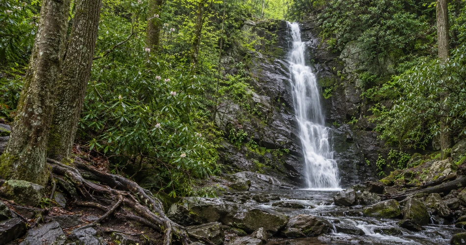
Some waterfalls require an entire morning. Cataract Falls does not, which is exactly why it works so well on a sightseeing day. The walk starts in the Sugarlands Visitor Center area and runs about 0.7 mile round trip through forest beside Fighting Creek. The waterfall itself drops roughly 40 feet and tends to look its best after rainfall, when the narrow cascade carries more water over the rock face.
The pleasure here is as much in the approach as the final photograph. The route passes beneath hardwoods, crosses a footbridge, and quickly replaces traffic noise with running water and forest sounds. It is short enough for visitors who do not want to devote the day to hiking, yet it still feels like a genuine park stop rather than a roadside photo break.
There is one important restraint: the National Park Service specifically warns visitors not to climb around the waterfall because serious injuries have occurred there. The safest view—and usually the most natural photograph—is from the bottom.
The Gatlinburg Trail Makes Town Feel Farther Away Than It Is
The Gatlinburg Trail is one of those places that works because it asks very little from the day. The trail follows the West Prong of the Little Pigeon River between the Sugarlands area and the edge of Gatlinburg, running about two miles one way. That makes it easy to walk only the portion that suits the available time rather than treating it as an all-or-nothing hike.
Its character is gentler than the big waterfall trails. The route passes through forest, runs close to water, and crosses the river on a pedestrian bridge. It is particularly good when a group wants a proper walk without committing to a steep mountain climb. The sound of water and broad woodland path provide a surprisingly quick change from downtown traffic.
It also has one distinction worth knowing: the Gatlinburg Trail and Oconaluftee River Trail are the only two park trails where leashed pets are permitted. Dogs must remain on a leash no longer than six feet.
For travelers who have already driven several hours, this is often a better first afternoon than immediately tackling a major summit trail.

Noah “Bud” Ogle Farmstead Deserves Time Beyond the Cabin
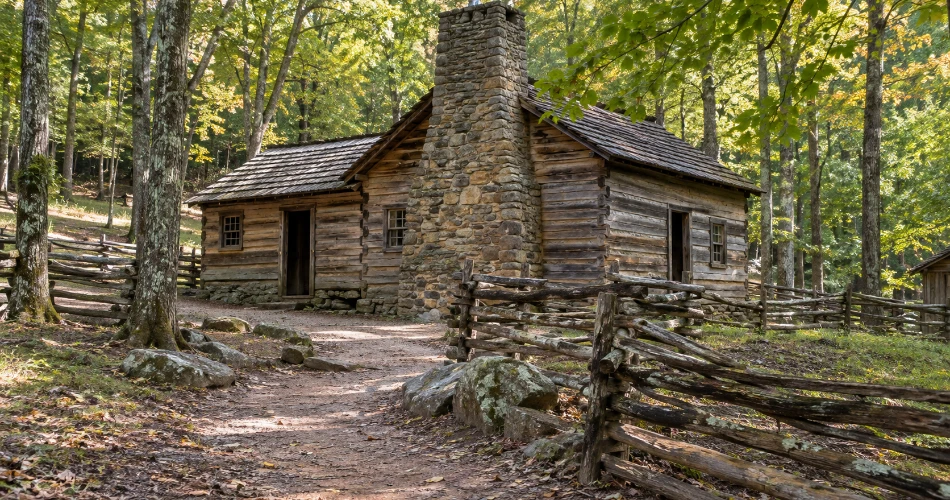
Drivers heading toward Roaring Fork often pass the Noah “Bud” Ogle site with their attention already on the road ahead. It is worth resisting that urge. The historic farmstead on Cherokee Orchard Road gives visitors something the scenic overlooks cannot: a physical sense of how families once lived in this mountain landscape.
The site includes a preserved saddlebag-style cabin, barn, and tub mill, with the latter structures reached along the roughly 0.8-mile Ogle Place Nature Trail. Walking the property changes it from “old cabin beside the road” into a much clearer picture of a working mountain homestead. The stream, forest, agricultural structures, and uneven terrain show how closely daily life was tied to the land.
This is also a good stop for travelers who like history but do not want a museum-style experience. There are no recreated streets or theatrical touches required. The buildings sit in the landscape that shaped them.
The farmstead comes before the entrance to Roaring Fork Motor Nature Trail, so it fits naturally into the same half-day outing.
Roaring Fork Is Better When the Car Keeps Getting Parked
The Roaring Fork Motor Nature Trail is technically a drive, but treating it only as one misses much of the point. The 5.5-mile, one-way road passes rushing streams, thick forest, historic buildings, trailheads, and small places where the best view is often outside the vehicle. It is narrow and winding enough to encourage a slower pace anyway.
After rain, Roaring Fork itself becomes especially lively, and the moisture gives the surrounding forest that deep green, almost polished appearance the Smokies do so well. Near the end of the route, Place of a Thousand Drips spills over a roadside rock face; its appearance changes greatly with recent rainfall.
This is also where a little restraint improves the day. There is no need to stop at every opening. A better approach is to choose a historic site, one short streamside pause, and perhaps one trailhead. Parking can be limited, and the road is seasonally closed. Buses, trailers, and motor homes are prohibited, so current road status should always be checked before heading up Cherokee Orchard Road.

Grotto Falls Is the Stop for Travelers Ready to Walk Farther
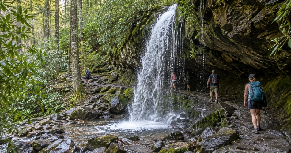
Grotto Falls is different from the quick roadside pauses in this guide because getting there requires a real hike. From the Trillium Gap Trailhead, the round trip to the waterfall is about 2.6 miles. The route passes through rhododendron and sections of old-growth forest before reaching a 25-foot waterfall where the trail runs behind the falling water—an unusual feature within Great Smoky Mountains National Park.
That short description can make the hike sound casual, but the mountain still sets the rules. Roots, rocks, stream crossings, mud, and wet surfaces are part of the experience, particularly after rain. Proper walking shoes make far more sense than footwear chosen for downtown.
Parking is the larger planning issue. Spaces at the Trillium Gap Trailhead are limited and frequently fill, especially during busy periods. The National Park Service advises visitors to have an alternative plan and notes that shuttle services can be considered.
Grotto Falls works best when it is chosen as the day's main walk rather than squeezed between several other major hikes.
Chimneys Picnic Area Turns a Road Break Into Part of the Trip
A picnic stop does not normally sound like one of the better Gatlinburg scenic stops, but Chimneys Picnic Area earns the description. It sits along Newfound Gap Road beside the West Prong of the Little Pigeon River at about 2,739 feet in elevation. There are 68 picnic sites, heavy forest cover, and a short 0.8-mile loop trail with a fairly steep ascent and descent.
The appeal is uncomplicated. Large rocks break the river into small channels, trees shade much of the area, and the sound of the water makes even a basic packed lunch feel like a proper pause in the drive. It is especially useful between Sugarlands and the higher elevations because it gives everyone time outside before continuing toward Newfound Gap.
A few practical habits matter here. Food and trash should never be left unattended because black bears live throughout the park. The provided grills are for charcoal rather than wood fires, and the picnic area operates seasonally.
Even without a meal, ten quiet minutes beside the river can justify the stop.

Newfound Gap Needs More Than a Photograph Through the Windshield
At 5,046 feet, Newfound Gap is the lowest drivable gap through Great Smoky Mountains National Park and one of the natural stopping points on US 441 between Gatlinburg and Cherokee. The parking area opens onto layered mountain ridges, but the elevation itself is part of the experience. Temperatures can be considerably cooler than in the lowlands, and rain in Gatlinburg can sometimes mean wintry conditions higher up.
Getting out of the car makes those differences immediately obvious. Wind moves differently across the ridge, cloud can arrive quickly, and the view changes every few minutes as light crosses the folds of the Smokies. The Appalachian Trail also passes through the area, giving visitors a chance to stand briefly on one of America's best-known long-distance trails without turning the day into a backpacking expedition.
Layers are useful even when downtown Gatlinburg feels warm. Parking can also be heavily used, so an early start generally produces a calmer visit than arriving in the busiest part of the afternoon.

Kuwohi Is Worth the Final Half-Mile on Foot
Kuwohi, formerly known as Clingmans Dome, is the highest point in Great Smoky Mountains National Park at 6,643 feet. The parking area already provides a strong high-country setting, but stopping there and turning around skips the reason most travelers made the drive. The observation tower sits another steep half-mile uphill, making the complete walk about one mile round trip. The surface is paved, but the grade is demanding enough that “short” should not be confused with “effortless.”
At the summit, the 45-foot observation tower rises above the spruce-fir forest and provides 360-degree views when the weather cooperates. Clouds, rain, and cold are common at this elevation, and temperatures can run 10–20°F cooler than surrounding lowlands.
That uncertainty is part of Kuwohi rather than a flaw. Some days bring miles of visibility; others bring shifting cloud moving through the trees.
Parking demand can exceed capacity, so visiting earlier and checking road and weather conditions before leaving Gatlinburg is sensible.

A Little Planning Keeps the Best Stops From Becoming Parking Searches
The strongest day around these Great Smoky Mountains stops is rarely the one with the most pins on a map. Two or three meaningful stops, one longer walk, and enough unscheduled time for weather or traffic usually work better than trying to force every overlook and waterfall into a single loop.
The practical details matter. Great Smoky Mountains National Park does not charge an entrance fee, but a parking tag is required when a vehicle is parked for longer than 15 minutes. Buying a tag does not guarantee a parking space, so busy trailheads still benefit from early arrival and a backup option.
A few useful habits keep the day flexible:
- Check official road, trail, and weather conditions before entering the park.
- Carry layers when heading toward Newfound Gap or Kuwohi.
- Use sturdy shoes for waterfall and forest trails.
- Build the day around one major walk rather than several competing hikes.
One particularly current point matters in 2026: Laurel Falls Trail remains closed for rehabilitation, with the park now anticipating reopening sometime in 2027.

The Stops People Remember Usually Begin After the Engine Is Off
Gatlinburg does not need to be treated as a race from one famous attraction to another. The mountains reward travelers who know when to stop moving. Sugarlands gives the day context. Cataract Falls turns half an hour into a genuine forest walk. The Gatlinburg Trail follows the river without demanding a major climb. Noah “Bud” Ogle adds human history to the landscape, while the Roaring Fork Motor Nature Trail proves that even a scenic drive becomes better when the doors open occasionally.
Higher up, Newfound Gap and Kuwohi show another side of the Smokies entirely—cooler air, changing forest, broad ridgelines, and weather that can rewrite the view in minutes. None of these places needs to be rushed simply because another marker is waiting farther down the road.
The most satisfying Gatlinburg day is often built around fewer stops than expected. It leaves enough room to hear the river, walk beyond the parking lot, wait for a cloud to clear, and return to town with more than a collection of photographs taken through glass.
Next post What to See Around Gatlinburg When You Want Something Different
Previous Post The Places Near Gatlinburg That Are Worth Leaving Town For
About Author
